1
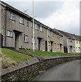
Houses above Glynrhondda Street, Treorchy
Steps lead up to houses on the west side of the street. The houses are above the east bank of the Rhondda River.
Image: © Jaggery
Taken: 9 Apr 2018
0.00 miles
2
Treorchy fire station and training tower
Set back about 80 metres from the A4061, Treorchy fire station is located on the bank of a stream, Nant Orci. Part of South Wales Fire and Rescue Service, the station serves the main town of Treorchy and surrounding villages such as Cwmparc, Ynyswen, Treherbert, Tynewydd, Blaenrhondda and Blaencwm, with an estimated total population of 21,000 people. There are 14 retained duty system firefighters and one administrative assistant. The station opened in December 1973.
Image: © Jaggery
Taken: 23 Jan 2012
0.03 miles
3
Ordnance Survey Cut Mark
This OS cut mark can be found on No189 Bute Street. It marks a point 169.091m above mean sea level.
Image: © Adrian Dust
Taken: 28 Apr 2017
0.03 miles
4
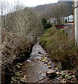
Downstream along Nant Orci between Treorchy and Ynyswen
The stream Nant Orci flows away from the Ynyswen Road bridge towards
its confluence with the Rhondda River a few metres beyond the pipe bridge.
Nant Orci here marks the boundary between Treorchy on the left and Ynyswen on the right.
Image: © Jaggery
Taken: 9 Apr 2018
0.03 miles
5
Grade II listed Ainon Welsh Baptist Chapel, Ynyswen
Located on the west side of the A4061, a few tens of metres on the Ynyswen side of the Treorchy boundary. Built in 1899 in the Sub-Classical style. Grade II listed in December 1996.
Image: © Jaggery
Taken: 23 Jan 2012
0.04 miles
6
Bouchard & Jones Ltd, Ynyswen
Premises of a plumbing and heating services company, located on Ynyswen Road (A4061) adjacent to the Treorchy boundary. The building was previously occupied by South Wales Caravan Centre Ltd.
Image: © Jaggery
Taken: 23 Jan 2012
0.04 miles
7
NW boundary of Treorchy
The A4061 passes from Ynyswen into Treorchy. The boundary sign is on a bridge across a stream, Nant Orci, about 50 metres from its confluence with the Rhondda Fawr river.
Image: © Jaggery
Taken: 23 Jan 2012
0.04 miles
8
Treorchy Car Sales
Located at 189 Bute Street (A4061) on the corner of Glan-yr-afon.
Image: © Jaggery
Taken: 23 Jan 2012
0.04 miles
9
Ynyswen boundary sign
The sign alongside the A4061 faces Treorchy.
The boundary is marked by the stream Nant Orci https://www.geograph.org.uk/photo/5737709 which flows under the road bridge here.
Image: © Jaggery
Taken: 9 Apr 2018
0.04 miles
10
Bute Street houses, Treorchy
Alongside the A4061 Bute Street. The house on the right is near Abergorki Hall. https://www.geograph.org.uk/photo/5737926
Image: © Jaggery
Taken: 14 Mar 2020
0.05 miles


