
IMAGES TAKEN NEAR TO
Llanfoist Street, PENTRE, CF41 7EE
Introduction
This page details the photographs taken nearby to Llanfoist Street, CF41 7EE by members of the Geograph project.
The Geograph project started in 2005 with the aim of publishing, organising and preserving representative images for every square kilometre of Great Britain, Ireland and the Isle of Man.

There are currently over 7.5m images from over14,400 individuals and you can help contribute to the project by visiting https://www.geograph.org.uk
Image Map
Images are licensed for reuse under creativecommons.org/licenses/by-sa/2.0
Notes
- Clicking on the map will re-center to the selected point.
- The higher the marker number, the further away the image location is from the centre of the postcode.
Image Listing (154 Images Found)
Images are licensed for reuse under creativecommons.org/licenses/by-sa/2.0
Image
Details
Distance
1
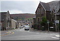
South along Church Street, Ton Pentre
Viewed from the corner of Church Road. Hebron Sunday School https://www.geograph.org.uk/photo/2679163 is on the left.
The English Congregational Church https://www.geograph.org.uk/photo/2678976 and two telecoms cabinets are on the right.
Image: © Jaggery
Taken: 8 Oct 2018
0.02 miles
2
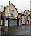
Nail Rehab, 6 Church Road, Ton Pentre
Beauty salon viewed in October 2018. A July 2016 Google Earth Street View shows MSL Music Centre here.
Image: © Jaggery
Taken: 8 Oct 2018
0.03 miles
3
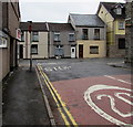
Junction of Maindy Road and Church Road, Ton Pentre
The B4223 Maindy Road joins the B4223 Church Road.
Image: © Jaggery
Taken: 8 Oct 2018
0.03 miles
4
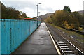
Blue fence at the edge of a river, Ton Pentre railway station
The fence is part of a bridge across the Rhondda Fawr river which passes under the NW side of Ton Pentre railway station. The manufacturer's name plate http://www.geograph.org.uk/photo/2682912 shows Horsehay Co Ld Shropshire 1922.
Image: © Jaggery
Taken: 3 Nov 2011
0.04 miles
5
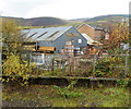
Bailey's Building Supplies, Ton Pentre
Chapel Street builders merchants' premises viewed from Ton Pentre railway station.
Image: © Jaggery
Taken: 3 Nov 2011
0.04 miles
6
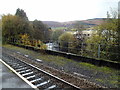
Rhondda Fawr flows away from Ton Pentre railway station
The NW part of Ton Pentre railway station http://www.geograph.org.uk/photo/2682877 is built on a bridge over the Rhondda Fawr river, seen here in the middle of the view flowing away from the station.
Image: © Jaggery
Taken: 3 Nov 2011
0.04 miles
7
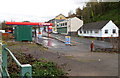
Murco filling station, Ton Pentre
The Ystrad Road Murco filling station was formerly a Texaco filling station. Viewed from Ton Pentre railway station. http://www.geograph.org.uk/photo/2682877
Image: © Jaggery
Taken: 3 Nov 2011
0.04 miles
8
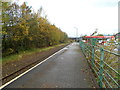
Ton Pentre railway station platform
A view to the NW along the only platform at Ton Pentre station, on the Rhondda Line between Ystrad Rhondda and Treorchy stations. The far end of the station is located on a bridge http://www.geograph.org.uk/photo/2682904 over the Rhondda Fawr river.
Image: © Jaggery
Taken: 3 Nov 2011
0.04 miles
9
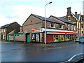
Corner Spar, Ton Pentre
The Spar store at 46-48 Church Road is on the corner of Maindy Road.
Image: © Jaggery
Taken: 3 Nov 2011
0.04 miles
10
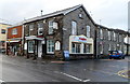
Fagins Ton Pentre
Restaurant and bar on the corner of Church Road and Maindy Road.
Image: © Jaggery
Taken: 3 Nov 2011
0.04 miles