1
Blue fence at the edge of a river, Ton Pentre railway station
The fence is part of a bridge across the Rhondda Fawr river which passes under the NW side of Ton Pentre railway station. The manufacturer's name plate http://www.geograph.org.uk/photo/2682912 shows Horsehay Co Ld Shropshire 1922.
Image: © Jaggery
Taken: 3 Nov 2011
0.02 miles
2
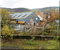
Bailey's Building Supplies, Ton Pentre
Chapel Street builders merchants' premises viewed from Ton Pentre railway station.
Image: © Jaggery
Taken: 3 Nov 2011
0.02 miles
3
Rhondda Fawr flows away from Ton Pentre railway station
The NW part of Ton Pentre railway station http://www.geograph.org.uk/photo/2682877 is built on a bridge over the Rhondda Fawr river, seen here in the middle of the view flowing away from the station.
Image: © Jaggery
Taken: 3 Nov 2011
0.02 miles
4
Murco filling station, Ton Pentre
The Ystrad Road Murco filling station was formerly a Texaco filling station. Viewed from Ton Pentre railway station. http://www.geograph.org.uk/photo/2682877
Image: © Jaggery
Taken: 3 Nov 2011
0.02 miles
5
Ton Pentre railway station platform
A view to the NW along the only platform at Ton Pentre station, on the Rhondda Line between Ystrad Rhondda and Treorchy stations. The far end of the station is located on a bridge http://www.geograph.org.uk/photo/2682904 over the Rhondda Fawr river.
Image: © Jaggery
Taken: 3 Nov 2011
0.02 miles
6
South along Church Street, Ton Pentre
Viewed from the corner of Church Road. Hebron Sunday School https://www.geograph.org.uk/photo/2679163 is on the left.
The English Congregational Church https://www.geograph.org.uk/photo/2678976 and two telecoms cabinets are on the right.
Image: © Jaggery
Taken: 8 Oct 2018
0.03 miles
7
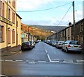
Eastern half of Parry Street, Ton Pentre
Parry Street is cut in two by Church Road (the B4223). Ahead is the eastern half, viewed looking past The New Inn. http://www.geograph.org.uk/photo/2678415
Image: © Jaggery
Taken: 3 Nov 2011
0.05 miles
8
Ton Pentre railway station viewed from Church Road bridge
The NW part of the station (nearest the camera) is built on a bridge across a river, the Rhondda Fawr. The single-platform station is on the Rhondda Line between Treorchy station about a mile behind the camera, and Ystrad Rhondda station, nearly a mile ahead.
Image: © Jaggery
Taken: 3 Nov 2011
0.05 miles
9
Ystrad Road passes Ton Pentre railway station
A view to the SE along the A4058 Ystrad Road. Ton Pentre railway station http://www.geograph.org.uk/photo/2682877 is on the Rhondda Line, between Treorchy station and Ystrad Rhondda station.
Image: © Jaggery
Taken: 3 Nov 2011
0.05 miles
10
4U Recruitment, Ton Pentre
Viewed from Ton Pentre railway station. http://www.geograph.org.uk/photo/2682877 A sign on the Ystrad Road premises shows
4U RECRUITMENT. Jobs in: Rail, London Underground, Crane & Plant, Construction, Driving, Industrial, Power & Utilities, Civil Engineering.
Image: © Jaggery
Taken: 3 Nov 2011
0.05 miles


