1
Heol y Derw, Evanstown
A street on the SW side of Coronation Road.
Image: © Jaggery
Taken: 11 Apr 2014
0.00 miles
2
Unclassified SW end of Abercerdin Road, Evanstown
Behind the camera, Abercerdin Road is part of the B4564. The curved white line in the foreground marks the course of the B4564, which is renamed Coronation Road beyond the left edge of the view.
The unclassified Abercerdin Road ahead descends towards Gilfach Goch Welfare Park.
Image: © Jaggery
Taken: 11 Apr 2014
0.03 miles
3
Road junction Evanstown.
Looking down the B4564 towards Gilfach Goch, with the Evanstown Community Centre in the left foreground.
Image: © Colin Pyle
Taken: 22 Aug 2008
0.04 miles
4
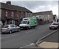
Asda home delivery van in Evanstown
Making a delivery at a Coronation Road house.
Image: © Jaggery
Taken: 11 Apr 2014
0.05 miles
5
Coronation Road, Evanstown
Viewed from the Kenry Street junction, where the B4564 Abercerdin Road turns through 90 degrees and is renamed the B4564 Coronation Road.
Image: © Jaggery
Taken: 11 Apr 2014
0.05 miles
6
Evanstown in the distance
Taken from just south of the junction of High St and Coronation Rd
Image: © John Lord
Taken: 12 Sep 2008
0.06 miles
7
Heol-y-Parc, Gilfach Goch
Street on the east side of Glannant Road.
Image: © Jaggery
Taken: 11 Apr 2014
0.06 miles
8
Up Coronation Road, Evanstown
Looking NW up the B4564 Coronation Road from the edge of a path to Gilfach Goch Welfare Park.
Image: © Jaggery
Taken: 11 Apr 2014
0.06 miles
9
Road Junction, Evanstown.
Road junction as the B4564 turns, with the Evanstown Community Centre on the right.
Image: © Colin Pyle
Taken: 22 Aug 2008
0.06 miles
10
Junction of the B4564 and Kenry Street, Evanstown
Kenry Street ascends from the B4564 which is named Abercerdin Road
on the right side of Kenry Street and Coronation Road to the left.
Image: © Jaggery
Taken: 11 Apr 2014
0.06 miles


