1
Woodstock Gardens, Pencoed
Image: © Colin Pyle
Taken: 9 Dec 2012
0.08 miles
2
Ordnance Survey Rivet
This OS rivet can be found on a rock 10m south of the track. It marks a point 96.576m above mean sea level.
Image: © Adrian Dust
Taken: 28 Apr 2018
0.18 miles
3
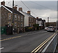
Wimborne Road, Pencoed
Looking SSW along Wimborne Road from near the Penprysg Road junction.
Image: © Jaggery
Taken: 14 Nov 2014
0.19 miles
4
Former chapel or church in Pencoed
Located between Caeau Duon (on this side) and Wimborne Road, this rusty-roofed building looks long derelict in November 2014. It is shown as a place of worship on some maps. I could see no clue here as to its former name or denomination. http://www.geograph.org.uk/photo/4245437 to another view.
Image: © Jaggery
Taken: 14 Nov 2014
0.19 miles
5
Former church or chapel in Pencoed
Located between Wimborne Road (on this side) and Caeau Duon, this building looks long derelict in November 2014. It is shown as a place of worship on some maps. I could see no clue here as to its former name or denomination. http://www.geograph.org.uk/photo/4245434 to another view.
Image: © Jaggery
Taken: 14 Nov 2014
0.19 miles
6
Turning circle at the northern end of Caeau Duon, Pencoed
Caeau Duon extends for about 300 metres from here to Heol-y-gerddi.
Image: © Jaggery
Taken: 14 Nov 2014
0.19 miles
7
Metal-framed bungalows, Wimborne Road, Pencoed
The rusty-roofed building http://www.geograph.org.uk/photo/4245437 at the right edge of the view is a derelict former place of worship.
Image: © Jaggery
Taken: 14 Nov 2014
0.20 miles
8
NE end of Caeau Duon, Pencoed
Houses beyond the turning circle. http://www.geograph.org.uk/photo/4245426
Image: © Jaggery
Taken: 14 Nov 2014
0.20 miles
9
Path from Caeau Duon to Wimborne Road, Pencoed
A path on the Caeau Duon side leads to steps up to Wimborne Road.
Image: © Jaggery
Taken: 14 Nov 2014
0.21 miles
10
Wimborne Road, Pencoed
From the corner of Penprysg Road.
Image: © Jaggery
Taken: 9 Nov 2014
0.22 miles


