
IMAGES TAKEN NEAR TO
Heol Ewenny, BRIDGEND, CF35 5QA
Introduction
This page details the photographs taken nearby to Heol Ewenny, CF35 5QA by members of the Geograph project.
The Geograph project started in 2005 with the aim of publishing, organising and preserving representative images for every square kilometre of Great Britain, Ireland and the Isle of Man.

There are currently over 7.5m images from over14,400 individuals and you can help contribute to the project by visiting https://www.geograph.org.uk
Image Map
Images are licensed for reuse under creativecommons.org/licenses/by-sa/2.0
Notes
- Clicking on the map will re-center to the selected point.
- The higher the marker number, the further away the image location is from the centre of the postcode.
Image Listing (40 Images Found)
Images are licensed for reuse under creativecommons.org/licenses/by-sa/2.0
Image
Details
Distance
1
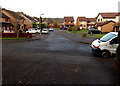
Heol Ewenny viewed from the edge of the Ewenny River
The river http://www.geograph.org.uk/photo/4239285 is a couple of metres behind the camera.
Image: © Jaggery
Taken: 9 Nov 2014
0.02 miles
2
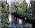
Ewenny River, Pencoed
The Ewenny flows towards a motorway bridge http://www.geograph.org.uk/photo/4239273 behind the camera.
Image: © Jaggery
Taken: 9 Nov 2014
0.02 miles
3
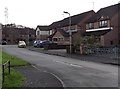
Heol Ewenny, Pencoed
Part of an area of modern houses between Coychurch Road and the Ewenny River.
Image: © Jaggery
Taken: 9 Nov 2014
0.03 miles
4
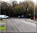
SE end of Heol Ewenny, Pencoed
The dark blue car in the background is parked at the edge of the Ewenny River. http://www.geograph.org.uk/photo/4239285
Image: © Jaggery
Taken: 9 Nov 2014
0.03 miles
5
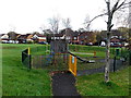
Playground at the edge of Heol Ewenny, Pencoed
In an area of modern houses between Coychurch Road and the Ewenny River.
Image: © Jaggery
Taken: 9 Nov 2014
0.04 miles
6
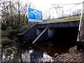
Motorway river bridge, Pencoed
The Ewenny River flows under the M4 motorway near junction 35.
Viewed from the riverbank near houses in Heol Ewenny.
Image: © Jaggery
Taken: 9 Nov 2014
0.05 miles
7
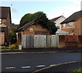
Heol Maes-yr-Haf electricity substation
Located in an area of modern houses between Coychurch Road and the Ewenny River. The identifier on the Western Power Distribution electricity substation is HEOL MAES-YR-HAF S/S 561245.
Image: © Jaggery
Taken: 9 Nov 2014
0.06 miles
8
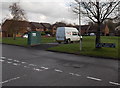
Left for Pont Newydd houses, right for Heol Ewenny houses, Pencoed
Viewed from Heol Maes-yr-Haf in an area of modern houses between Coychurch Road and the Ewenny River. The dark green cabinet is Beechwood Sewage Pumping Station, Welsh Water Asset No. 53075.
Image: © Jaggery
Taken: 9 Nov 2014
0.06 miles
9
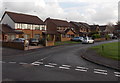
Pont Newydd houses in Pencoed
Part of an area of modern houses between Coychurch Road and the Ewenny River.
Image: © Jaggery
Taken: 9 Nov 2014
0.07 miles
10
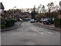
Southern arm of Heol Maes-yr-Haf, Pencoed
Viewed from the main course of Heol Maes-yr-Haf looking towards
the embankment carrying the M4 motorway near junction 35.
Image: © Jaggery
Taken: 9 Nov 2014
0.09 miles