1
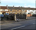
Castle Street houses north of Treharne Row, Maesteg
Treharne Row http://www.geograph.org.uk/photo/4227401 is on the left.
Image: © Jaggery
Taken: 30 Oct 2014
0.02 miles
2
The Cast Iron 'Talbot Bridge,' Maesteg
Road bridge cast at the Maesteg Ironworks c.1835
Image: © David Lewis
Taken: Unknown
0.03 miles
3
Ornate gates, Talbot Terrace, Maesteg
The gates have two oval motifs each depicting four daffodils. Across the top of the gates is PUDDLER'S COTTAGE.
Image: © Jaggery
Taken: 17 Nov 2011
0.03 miles
4
Treharne Row, Maesteg
Viewed across the A4063 Castle Street. Treharne Row extends for 50 metres,
ending near the east bank of the River Llynfi.
Image: © Jaggery
Taken: 30 Oct 2014
0.04 miles
5
The cast iron Talbot Bridge, Maesteg
An early example of an iron bridge (1835), after recent renovation.
Image: © David Lewis
Taken: 16 Jan 2009
0.04 miles
6
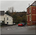
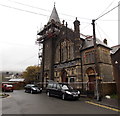
Bend ahead in Castle Street, Maesteg
The A4063 Castle Street heads NW away from the centre of Maesteg.
Scaffolding is on the Masonic Temple http://www.geograph.org.uk/photo/4227487 on the right.
Image: © Jaggery
Taken: 30 Oct 2014
0.04 miles
7
Maesteg Rugby Club
Image: © Chris Andrews
Taken: 24 Oct 2012
0.05 miles
8
Ordnance Survey Cut Mark
This OS cut mark can be found on the SW face of the Zoar Chapel. It marks a point 135.133m above mean sea level.
Image: © Adrian Dust
Taken: 9 Mar 2016
0.05 miles
9
Valleys to Coast housing, Treharne Row, Maesteg
Located on the east bank of the River Llynfi. A notice on a fence shows V2C (Valleys to Coast housing). V2C is a not-for-profit housing association providing affordable homes to rent or buy in the County Borough of Bridgend.
Image: © Jaggery
Taken: 30 Oct 2014
0.05 miles
10
Zoar Chapel of Rest, Maesteg
The building on the corner of Zoar Avenue and Zoar Place used to be Zoar Independent Chapel.
After the chapel closed in 1978, it was converted for use as a chapel of rest.
Image: © Jaggery
Taken: 30 Oct 2014
0.05 miles


