
IMAGES TAKEN NEAR TO
Llynfi Road, MAESTEG, CF34 9DT
Introduction
This page details the photographs taken nearby to Llynfi Road, CF34 9DT by members of the Geograph project.
The Geograph project started in 2005 with the aim of publishing, organising and preserving representative images for every square kilometre of Great Britain, Ireland and the Isle of Man.

There are currently over 7.5m images from over14,400 individuals and you can help contribute to the project by visiting https://www.geograph.org.uk
Image Map
Images are licensed for reuse under creativecommons.org/licenses/by-sa/2.0
Notes
- Clicking on the map will re-center to the selected point.
- The higher the marker number, the further away the image location is from the centre of the postcode.
Image Listing (151 Images Found)
Images are licensed for reuse under creativecommons.org/licenses/by-sa/2.0
Image
Details
Distance
1
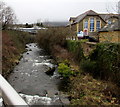
Upstream along the Llynfi, Maesteg
Viewed from a footbridge at the western end of Plasnewydd Street.
The Llynfi is a tributary of the River Ogmore (Afon Ogwr in Welsh).
Plasnewydd Primary School is on the right. An Aldi supermarket is in the distance.
Image: © Jaggery
Taken: 25 Feb 2015
0.03 miles
2
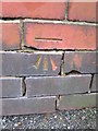
Ordnance Survey Cut Mark
This OS cut mark can be found on the wall of No1 Exchange Street. It marks a point 137.620m above mean sea level.
Image: © Adrian Dust
Taken: 9 Mar 2016
0.06 miles
3
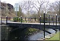
The cast iron Talbot Bridge, Maesteg
An early example of an iron bridge (1835), after recent renovation.
Image: © David Lewis
Taken: 16 Jan 2009
0.06 miles
4
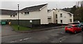
Valleys to Coast housing, Treharne Row, Maesteg
Located on the east bank of the River Llynfi. A notice on a fence shows V2C (Valleys to Coast housing). V2C is a not-for-profit housing association providing affordable homes to rent or buy in the County Borough of Bridgend.
Image: © Jaggery
Taken: 30 Oct 2014
0.06 miles
5
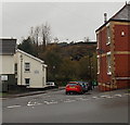
Treharne Row, Maesteg
Viewed across the A4063 Castle Street. Treharne Row extends for 50 metres,
ending near the east bank of the River Llynfi.
Image: © Jaggery
Taken: 30 Oct 2014
0.07 miles
6
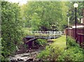
The Cast Iron 'Talbot Bridge,' Maesteg
Road bridge cast at the Maesteg Ironworks c.1835
Image: © David Lewis
Taken: Unknown
0.08 miles
7
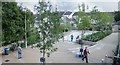
Maesteg Riverside
The result of riverside improvements by Bridgend CBC, partially funded by the Welsh Assembly Government.
Image: © Kev Griffin
Taken: 27 Sep 2007
0.08 miles
8
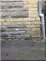
Ordnance Survey Cut Mark
This OS cut mark can be found on the NE face of the school. It marks a point 132.341m above mean sea level.
Image: © Adrian Dust
Taken: 9 Mar 2016
0.08 miles
9
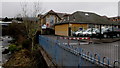
Plasnewydd Primary School, Maesteg
The school is on the east bank of the Llynfi River.
Image: © Jaggery
Taken: 25 Feb 2015
0.08 miles
10
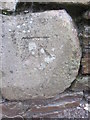
Ordnance Survey Cut Mark
This OS cut mark can be found on the wall to the south of the path. It marks a point 140.809m above mean sea level.
Image: © Adrian Dust
Taken: 9 Mar 2016
0.08 miles