1
Ordnance Survey Cut Mark
This OS cut mark can be found on the Traveller's Rest, High Street. It marks a point 145.576m above mean sea level.
Image: © Adrian Dust
Taken: 10 Nov 2020
0.03 miles
2
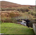
Former railway bridge, Nantyffyllon
A track passes under a stone bridge that formerly carried a railway on the east bank of the River Llynfi.
Image: © Jaggery
Taken: 17 Nov 2011
0.04 miles
3
High Street Stores & Off Licence, Nantyffyllon
The Lifestyle Express shop was formerly Moruzzi's General Store.
Image: © Jaggery
Taken: 17 Nov 2011
0.04 miles
4
Nantyffyllon: postbox № CF34 10, High Street
A Victorian postbox set into a wall on the main road, along which we are looking towards Maesteg. The box is currently missing its collection-times plate.
Image: © Chris Downer
Taken: 1 Feb 2010
0.05 miles
5
Travellers Rest, Nantyffyllon
Pub at 95 High Street.
Image: © Jaggery
Taken: 17 Nov 2011
0.05 miles
6
Brown St, from Uplands Drive, Maesteg
Image: © John Lord
Taken: 10 Oct 2008
0.09 miles
7
Nantyffyllon Surgery
Located at 77 High Street.
Image: © Jaggery
Taken: 17 Nov 2011
0.09 miles
8
The Co-operative Pharmacy, Nantyffyllon
Located at 77a High Street. Nantyffyllon Surgery http://www.geograph.org.uk/photo/3009375 is just out of shot on the left at 77 High Street.
Image: © Jaggery
Taken: 17 Nov 2011
0.09 miles
9
Footbridge across the Llynfi to a former railway embankment, Nantyffyllon
Viewed from the High Street side looking towards an embankment that formerly carried a railway.
Image: © Jaggery
Taken: 17 Nov 2011
0.09 miles
10
Former railway bridge over the River Llynfi, Nantyffyllon
The railings remain in place on the side of the bridge. The railway lines were removed many years ago.
Image: © Jaggery
Taken: 17 Nov 2011
0.09 miles


