1
Harvey Street, Maesteg
Viewed from South Parade looking along Harvey Street towards Lewis Road.
Image: © Jaggery
Taken: 30 Oct 2014
0.02 miles
2
Lewis Road, Maesteg
From the corner of Crown Road. Lewis Road leads to Harvey Street, South Parade and Treharne Cottages.
Image: © Jaggery
Taken: 30 Oct 2014
0.04 miles
3
Ordnance Survey Cut Mark
This OS cut mark can be found on the wall SE side of South Parade. It marks a point 128.236m above mean sea level.
Image: © Adrian Dust
Taken: 11 Nov 2020
0.04 miles
4
South Parade side of a low railway bridge in Maesteg
The headroom on the railway bridge east of Maesteg railway station is 8' 6". In 2014 vehicular access under the bridge is blocked by metal posts, though most motorbikes could probably get through.
South Parade is on this side, Ferriers Row is on the far side.
Image: © Jaggery
Taken: 30 Oct 2014
0.04 miles
5
Ferriers Row, Maesteg
Viewed from Castle Street along Ferriers Row towards a railway bridge, where metals posts across the road block vehicular access, hence the No Through Road symbol on the name sign on the left.
Image: © Jaggery
Taken: 30 Oct 2014
0.05 miles
6
Low railway bridge in Maesteg
Headroom of 8' 6" is shown on the railway bridge east of Maesteg railway station.
In 2014 vehicular access under the bridge is blocked by metal posts, though most motorbikes could probably get through. Ferriers Row is on this side of the bridge, South Parade on the far side.
Image: © Jaggery
Taken: 30 Oct 2014
0.05 miles
7
Treharne Cottages, Maesteg
Viewed across South Parade.
Image: © Jaggery
Taken: 30 Oct 2014
0.05 miles
8
Maesteg South Signal Box
This box, seen from a southbound special train, controlled the south end of Maesteg Castle Street Goods Yard and a series of wagon storage sidings. Immediately beyond the box the line crosses Bridgend Road. Passenger train services, which ran between Bridgend and Blaengwynfi, were withdrawn from Maesteg in 1970 but a new terminus station with services from Cardiff and Bridgend was opened in 1992. Only a single line now exists at this point.
Image: © A-M-Jervis
Taken: 7 Jun 1969
0.05 miles
9
Bethel Community Church in Maesteg
Not apparent in this view, the church building extends back 35 metres from the south side of Castle Street. Viewed in late October 2014. The name on the building in a Google Earth Street View taken in June 2011 was Hope Church. The Salvation Army Maesteg Corps building http://www.geograph.org.uk/photo/4225527 is on the right.
Image: © Jaggery
Taken: 30 Oct 2014
0.06 miles
10
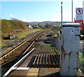
Eastern end of Maesteg railway station
Maesteg is the terminus of the line from Bridgend. The next station is Ewenny Road, about 750 metres, or half a mile, away. A notice on the grey box states Special Telephone Not For 999 Calls.
Image: © Jaggery
Taken: 17 Nov 2011
0.06 miles


