Bethel Community Church in Maesteg
Introduction
The photograph on this page of Bethel Community Church in Maesteg by Jaggery as part of the Geograph project.
The Geograph project started in 2005 with the aim of publishing, organising and preserving representative images for every square kilometre of Great Britain, Ireland and the Isle of Man.

There are currently over 7.5m images from over 14,400 individuals and you can help contribute to the project by visiting https://www.geograph.org.uk
Bethel Community Church in Maesteg
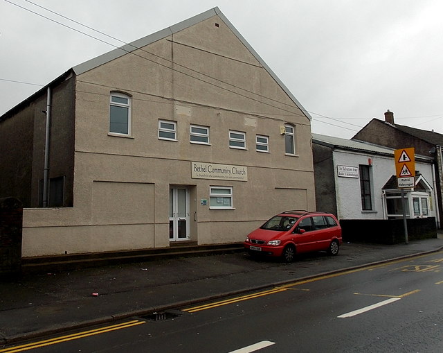
Image: © Jaggery Taken: 30 Oct 2014
Not apparent in this view, the church building extends back 35 metres from the south side of Castle Street. Viewed in late October 2014. The name on the building in a Google Earth Street View taken in June 2011 was Hope Church. The Salvation Army Maesteg Corps building http://www.geograph.org.uk/photo/4225527 is on the right.
Images are licensed for reuse under creativecommons.org/licenses/by-sa/2.0
Image Location
Latitude
51.608525
Longitude
-3.652717