
IMAGES TAKEN NEAR TO
South View, BRIDGEND, CF33 6DG
Introduction
This page details the photographs taken nearby to South View, CF33 6DG by members of the Geograph project.
The Geograph project started in 2005 with the aim of publishing, organising and preserving representative images for every square kilometre of Great Britain, Ireland and the Isle of Man.

There are currently over 7.5m images from over14,400 individuals and you can help contribute to the project by visiting https://www.geograph.org.uk
Image Map
Images are licensed for reuse under creativecommons.org/licenses/by-sa/2.0
Notes
- Clicking on the map will re-center to the selected point.
- The higher the marker number, the further away the image location is from the centre of the postcode.
Image Listing (10 Images Found)
Images are licensed for reuse under creativecommons.org/licenses/by-sa/2.0
Image
Details
Distance
1

Llys Ton, Kenfig Hill
Llys Ton was built in 2011 on the Waunbant Road site of the demolished Troed y Ton care home.
The purpose-built complex provides accommodation for 70 older people in 40 flats.
There is an on-site care staff, a non-resident management team and community alarm service.
The literal translation of Llys Ton is Wave Court but Ton is also the name of a nearby hill.
Image: © Jaggery
Taken: 29 Nov 2012
0.06 miles
2
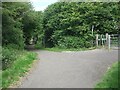
Cycle path at Pyle
A view part way along a cycle path which runs for nearly a kilometre along some of the route of the former Dyffryn Llynfi & Porthcawl Railway. Frog Pond Wood Nature Reserve lies at the southern end of the path.
Access to and from the road Woodlands Park is possible through the cycle barrier seen.
The cycle path is not a part of National Cycle Route 4. The latter passes through the area a short distance to the north.
Image: © eswales
Taken: 15 Jun 2022
0.10 miles
3
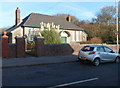
Kenfig Hill Clinic
The inscription in stone above the doorway of the Waunbant Road building is
CHILD WELFARE CLINIC
KENFIG HILL
1938.
Image: © Jaggery
Taken: 29 Nov 2012
0.16 miles
4
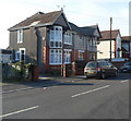
Waunbant Road houses, Kenfig Hill
Viewed from near Kenfig Hill Clinic. http://www.geograph.org.uk/photo/3260294
Waunbant Road is also known locally as Stormy Road, because it leads to Stormy Down near Bridgend.
Image: © Jaggery
Taken: 29 Nov 2012
0.19 miles
5
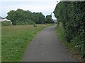
Cycle path at Pyle (2)
A view very close to the northern end of the cycle path which runs southwards to Frog Pond Wood Local Nature Reserve and a spot in the east of Village Farm Industrial Estate.
Image: © eswales
Taken: 15 Jun 2022
0.20 miles
6
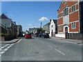
Waunbant Road approaching Commercial Street
Image: © Colin Pyle
Taken: 27 Aug 2010
0.21 miles
7
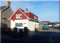
The Old Telephone Exchange, Kenfig Hill
Now in residential use, this Waunbant Road building bears the nameplate The Old Telephone Exchange. Doubtless it has been much altered, internally and externally, since its change of use.
The coaches in the background are at the edge of the Express Motors depot.
Image: © Jaggery
Taken: 29 Nov 2012
0.21 miles
9
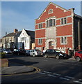
Former St David's church, Kenfig Hill
Viewed along Waunbant Road from the corner of Park Street. The larger, mainly brick,
building is the disused St David's church. The inscription in stone above the doorway is
ST DAVID'S PRESBYTERIAN CHURCH IN WALES 1928.
The smaller white building is the former vestry, latterly used for worship instead of the larger building. There was no name board to indicate that this is still in use. The year 1909 is inscribed in stone on the facade of the vestry. Waunbant Road is also known locally as Stormy Road, because it leads to Stormy Down near Bridgend.
Image: © Jaggery
Taken: 29 Nov 2012
0.24 miles
10

Former Carolanne shop, Kenfig Hill
Located on the corner of Waunbant Road and Bridge Street.
The name and business details (nursery equipment and baby wear) remain on the shop front though there is no stock inside. A Google Earth Street View taken more than three years earlier, in August 2009, also showed an empty shop.
Image: © Jaggery
Taken: 29 Nov 2012
0.25 miles