IMAGES TAKEN NEAR TO
Heol Nant, BRIDGEND, CF33 4DG
Introduction
This page details the photographs taken nearby to Heol Nant, CF33 4DG by members of the Geograph project.
The Geograph project started in 2005 with the aim of publishing, organising and preserving representative images for every square kilometre of Great Britain, Ireland and the Isle of Man.

There are currently over 7.5m images from over14,400 individuals and you can help contribute to the project by visiting https://www.geograph.org.uk
Image Map
Images are licensed for reuse under creativecommons.org/licenses/by-sa/2.0
Notes
- Clicking on the map will re-center to the selected point.
- The higher the marker number, the further away the image location is from the centre of the postcode.
Image Listing (17 Images Found)
Images are licensed for reuse under creativecommons.org/licenses/by-sa/2.0
Image
Details
Distance
1
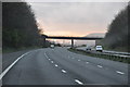
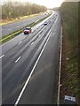
Bridgend District : The M4 Motorway
The M4 Motorway heading westbound through the Bridgend area.
Image: © Lewis Clarke
Taken: 10 Apr 2014
0.10 miles
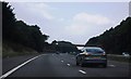
3
Bridgend District : The M4 Motorway
The M4 Motorway heading eastbound as it passes through the Bridgend area.
Image: © Lewis Clarke
Taken: 11 Apr 2014
0.12 miles
4
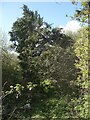
Public footpath approaching Mawdlam from the south east
The path here passes along the top of a cutting on the M4 motorway, which runs just beyond and below the row of trees beside the wall.
Image: © eswales
Taken: 1 Apr 2022
0.12 miles
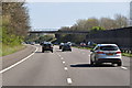
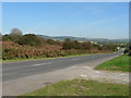
5
M4 motorway
View of M4 motorway towards Bridgend, taken from Mawdlam bridge.
Image: © Alan Hughes
Taken: 20 Dec 2015
0.12 miles
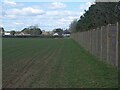
6
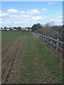
Public footpath above the M4 south east of Mawdlam
A public footpath runs for several hundred metres alongside a fence at the top of a motorway cutting here. It offers some views of the motorway. Mawdlam is seen in the distance in the image.
Image: © eswales
Taken: 1 Apr 2022
0.14 miles
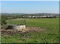
8
Road to Cornelly beside Kenfig National Nature Reserve
Image: © Mick Lobb
Taken: 26 Sep 2008
0.20 miles
9

Llwybr i Fawdlam / Path to Mawdlan
Llwybr troed cyhoeddus i Fawdlamyn rhedeg yn gyfochrog â'r M4.
A public footpath to Mawdlam runs parallel with the M4.
Image: © Alan Richards
Taken: 21 Nov 2023
0.20 miles
10
Fallen tree blocking a public footpath at Mawdlam
This fallen conifer on a public footpath towards Kenfig was unpassable.
Image: © eswales
Taken: 1 Apr 2022
0.20 miles