1
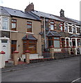
Former Anglican church in Blaengarw
Viewed across the corner of Church Street and Church Place.
Now in residential use, the building was St James Church, which closed in 2004.
Image: © Jaggery
Taken: 15 Aug 2014
0.00 miles
2
Church Street houses, Blaengarw
The bellcote on the right is on the former St James Church. http://www.geograph.org.uk/photo/4120958
Image: © Jaggery
Taken: 15 Aug 2014
0.01 miles
3
Clwb Calon L?n, Blaengarw
Club on the corner of Station Street and Church Street. Old maps show Blaengarw railway station nearby, formerly the northern terminus of the Garw Valley line. Passenger services ended in 1953.
Image: © Jaggery
Taken: 15 Aug 2014
0.03 miles
4
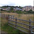
Valley view towards Clwb Calon L?n, Blaengarw
Looking across the Garw Valley towards Clwb Calon Lân http://www.geograph.org.uk/photo/4120866 on the right.
Image: © Jaggery
Taken: 15 Aug 2014
0.03 miles
5
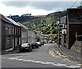
Blaengarw Station (remains)
View NW to surviving collieries at head of Garw Valley, but this terminus of the branch from Bridgend and Tondu had been closed to passengers for over nine years (9/2/53). Nowadays (2010) the heritage Garw Railway is active down the valley at Pontycymmer.
Image: © Ben Brooksbank
Taken: 1 Jun 1962
0.03 miles
6
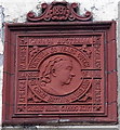
Queen Victoria Diamond Jubilee tablet in Blaengarw
On the Station Street wall of Clwb Calon Lân. http://www.geograph.org.uk/photo/4120866 Dated 1897, the tablet lists the areas over which Victoria ruled. EGYPT is listed as well as AFRICA, and BURMAH is so spelt.
Image: © Jaggery
Taken: 15 Aug 2014
0.03 miles
7
Side entrance to Blaengarw Primary School
From Church Place, Blaengarw. The main entrances are around the corner, in Station Street.
Image: © Jaggery
Taken: 15 Aug 2014
0.03 miles
8
Zigzag road markings, Church Place, Blaengarw
The yellow lines mark a no parking or stopping zone outside Blaengarw Primary School. The bilingual text on the road ahead shows SCHOOL KEEP CLEAR and its Welsh language equivalent.
Image: © Jaggery
Taken: 15 Aug 2014
0.04 miles
9
Station Street, Blaengarw
Station Street descends from the A4064, into the Garw Valley. This was a route to Blaengarw railway station, formerly the northern terminus of the Garw Valley line. Passenger services ended in 1953.
Image: © Jaggery
Taken: 15 Aug 2014
0.04 miles
10
Four gables, Station Street, Blaengarw
The row of four houses is at the SW end of Station Street, near the corner of Church Street.
Image: © Jaggery
Taken: 15 Aug 2014
0.04 miles


