Queen Victoria Diamond Jubilee tablet in Blaengarw
Introduction
The photograph on this page of Queen Victoria Diamond Jubilee tablet in Blaengarw by Jaggery as part of the Geograph project.
The Geograph project started in 2005 with the aim of publishing, organising and preserving representative images for every square kilometre of Great Britain, Ireland and the Isle of Man.

There are currently over 7.5m images from over 14,400 individuals and you can help contribute to the project by visiting https://www.geograph.org.uk
Queen Victoria Diamond Jubilee tablet in Blaengarw
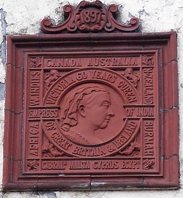
Image: © Jaggery Taken: 15 Aug 2014
On the Station Street wall of Clwb Calon Lân. http://www.geograph.org.uk/photo/4120866 Dated 1897, the tablet lists the areas over which Victoria ruled. EGYPT is listed as well as AFRICA, and BURMAH is so spelt.
Images are licensed for reuse under creativecommons.org/licenses/by-sa/2.0
Image Location
Latitude
51.623533
Longitude
-3.588253