
IMAGES TAKEN NEAR TO
Howell Street, BRIDGEND, CF32 7RE
Introduction
This page details the photographs taken nearby to Howell Street, CF32 7RE by members of the Geograph project.
The Geograph project started in 2005 with the aim of publishing, organising and preserving representative images for every square kilometre of Great Britain, Ireland and the Isle of Man.

There are currently over 7.5m images from over14,400 individuals and you can help contribute to the project by visiting https://www.geograph.org.uk
Image Map
Images are licensed for reuse under creativecommons.org/licenses/by-sa/2.0
Notes
- Clicking on the map will re-center to the selected point.
- The higher the marker number, the further away the image location is from the centre of the postcode.
Image Listing (33 Images Found)
Images are licensed for reuse under creativecommons.org/licenses/by-sa/2.0
Image
Details
Distance
1
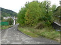
Howell Street, Nant-y-moel
The Ogwr Vale cycle trail peters out here unless taking steps to the right and climbing the Bwlch on the A4061.
Image: © Mick Lobb
Taken: 16 Sep 2008
0.02 miles
2

Nant-y-moel in the upper Ogmore valley
Seen from the A4061 near the north end of the long rows of roadside terraces.
Image: © Andrew Hill
Taken: 20 Oct 2008
0.03 miles
3

Bus crossing Afon Ogwr bridge
In Nantymoel.
Image: © Alan Hughes
Taken: 28 May 2025
0.04 miles
4

Bridge and bus stop
Afon Ogwr, Nantymoel.
Image: © Alan Hughes
Taken: 28 May 2025
0.05 miles
5

Allotments and terraced housing
The inhabitants have to cross the road to get to their patch of land. A mixture of gardens, sheds … and rubbish dumps!
Image: © Alan Hughes
Taken: 28 May 2025
0.07 miles
6
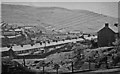
Nant-y-Moel and Mynydd yr Aber, 1962
View southwards at the head of the Ogmore Valley.
Image: © Ben Brooksbank
Taken: 1 Jun 1962
0.07 miles
7
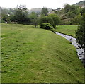
Riverbank in Nantymoel
Above the west side of the infant River Ogmore west of Commercial Street.
Image: © Jaggery
Taken: 29 Aug 2018
0.08 miles
8
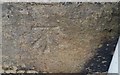
Ordnance Survey Cut Mark
This OS cut mark can be found on No22 North Vale View. It marks a point 223.169m above mean sea level.
Image: © Adrian Dust
Taken: 29 May 2017
0.08 miles
9
River Ogmore footbridge in Nantymoel
The bridge near Commercial Street crosses the infant River Ogmore. https://www.geograph.org.uk/photo/5892769
Image: © Jaggery
Taken: 29 Aug 2018
0.10 miles
10
River Ogmore Flowing Through Nant-y-Moel
Image: © Lewis Potter
Taken: 4 Apr 2013
0.10 miles