1
War Memorial, Pentyrch .
The War Memorial at Pentyrch can be found adjacent to Heol Goch.
Image: © Peter Wasp
Taken: 4 Apr 2007
0.07 miles
2
Ordnance Survey Cut Mark
This OS cut mark can be found on No13 Heol y Pentre. It marks a point 151.419m above mean sea level.
Image: © Adrian Dust
Taken: 28 Oct 2019
0.09 miles
3
Junction of Heol Goch and Cefn Bychan, Pentyrch
At the eastern edge of the village. Dead end Cefn Bychan is on the right.
Heol Goch leads to Taffs Well and Morganstown.
Image: © Jaggery
Taken: 22 Sep 2017
0.10 miles
4
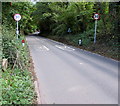
Heol Goch beyond Pentyrch
The 20mph speed limit in Pentyrch increases to 30mph. This way to Taffs Well and Morganstown.
Image: © Jaggery
Taken: 22 Sep 2017
0.10 miles
5
Cefn Bychan houses, Pentyrch
The row alongside Heol Goch extends for 30 metres.
Image: © Jaggery
Taken: 22 Sep 2017
0.11 miles
6
Dim Stydiau Ffordd/No Road Studs, Heol Goch, Pentyrch
In September 2017, the temporary sign is on a lamppost at the eastern edge of the village,
on the approach to Redrow's Awel y Garth development of 4- and 5-bedroom houses.
Image: © Jaggery
Taken: 22 Sep 2017
0.11 miles
7
Welcome to / Croeso i / Pentyrch
The English/Welsh sign is alongside Heol Goch at the eastern boundary of Pentyrch,
a village in the City and County of Cardiff.
Image: © Jaggery
Taken: 22 Sep 2017
0.11 miles
8
Heol Goch - Pentyrch
The road leads down over a wooded hillside to Taffs Well and main routes to the north, east,west and into Cardiff.
Image: © Mick Lobb
Taken: 4 Mar 2010
0.11 miles
9
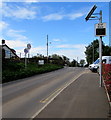
Araf/Slow sign alongside Heol Goch, Pentyrch
Currently off, the sign illuminates to display the speed of an approaching vehicle,
in green if within the 20mph speed limit, in red if exceeding the limit.
Image: © Jaggery
Taken: 22 Sep 2017
0.12 miles
10
Clos Goch, Pentyrch
Part of Redrow's Awel y Garth development of 4- and 5-bedroom houses at the eastern edge of the village, viewed from Heol Goch in September 2017 when construction work is ongoing.
A small red and white notice near a lamppost states that this house is now occupied.
Image: © Jaggery
Taken: 22 Sep 2017
0.12 miles


