1
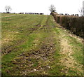
Public footpath NE of Llantrisant Road near Radyr Cardiff
A sign pointing this way shows Public Footpath, though Public Track would be a better description.
Image: © Jaggery
Taken: 5 Mar 2015
0.04 miles
2
Clos Parc Radur towards Radyr, Cardiff
Viewed from the A4119 Llantrisant Road junction.
This is the connecting road to an area of houses in Radyr.
The speed limit reduces to 30mph at the speed bumps ahead.
Image: © Jaggery
Taken: 5 Mar 2015
0.07 miles
3
New junction on A4119
A new road linking housing in Radyr with the A4119.
Image: © Alan Hughes
Taken: 17 Oct 2018
0.08 miles
4
Junction of Clos Parc Radur and Llantrisant Road near Radyr, Cardiff
The street name sign on the left shows CLOS PARC RADUR. The black arrow on the sign on the right points left along the A4119 Llantrisant Road towards Radyr and Cardiff city centre.
Image: © Jaggery
Taken: 5 Mar 2015
0.09 miles
5
Llantrisant Road roundabout
A view of the roundabout from the minor road, looking towards the A4119 west of Radyr.
Image: © Martyn Harries
Taken: 8 Jun 2011
0.10 miles
6
Stile to a mass of brambles near Radyr, Cardiff
On the north side of the A4119 Llantrisant Road. On a small white disc showing Public Footpath, a yellow arrow points to an overgrown area, impenetrable even in the dormant days of early March. However, the gate is slightly open, giving access to the public footpath http://www.geograph.org.uk/photo/4373666 through a field, though the walker must be wary of brambles extending left beyond the stile.
Image: © Jaggery
Taken: 5 Mar 2015
0.10 miles
7
Llantrisant Road/Clos Parc Radyr roundabout
Image: © Colin Pyle
Taken: 4 Jan 2011
0.11 miles
8
Clos Parc Radur junction ahead near Radyr, Cardiff
The red bar on the sign alongside the A4119 Llantrisant Road shows that Clos Parc Radur is not a through road.
Image: © Jaggery
Taken: 5 Mar 2015
0.11 miles
9
Bridleway between Llantrisant Road and Radyr
Image: © John Light
Taken: 5 Jan 2010
0.13 miles
10
Bridleway through Radyr Farm
Image: © John Light
Taken: 6 Mar 2021
0.15 miles


