1
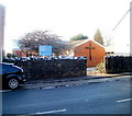
Bethesda United Reformed Church, Tongwynlais
Located between 11 and 13 Merthyr Road, almost opposite the village hall. http://www.geograph.org.uk/photo/2181681
Image: © Jaggery
Taken: 29 Nov 2010
0.03 miles
2
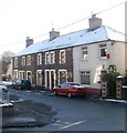
Queen Street houses, Tongwynlais
Houses on the north side of Queen Street, between Hermon CM chapel http://www.geograph.org.uk/photo/2181392 and the corner of Cross Street.
Image: © Jaggery
Taken: 29 Nov 2010
0.03 miles
3
Tongwynlais Village Hall
Set back about 20 metres from Merthyr Road, in a fenced-off area with padlocked entry gates. The hall is at the SW edge of Greenmeadow Wood.
Image: © Jaggery
Taken: 29 Nov 2010
0.04 miles
4
Tongwynlais Post Office
The post office is at 21 Merthyr Road. Adjacent shops in view are Tongwynlais Pharmacy and Tongwynlais Cycle Care, which is having a closing down sale.
Image: © Jaggery
Taken: 29 Nov 2010
0.04 miles
5
St Michael's Close, Tongwynlais
A short cul-de-sac of modern houses, adjacent to the edge of St Michael and All Angels Church. http://www.geograph.org.uk/photo/2180907
Image: © Jaggery
Taken: 29 Nov 2010
0.04 miles
6
Two shops and church bell tower, Tongwynlais
The view SE along Merthyr Road towards the church http://www.geograph.org.uk/photo/2180907 bell tower. The shops are
Castle Kitchen (baguettes, sandwiches, panini)
Andrew Cox, hair specialists.
Another shop, set back further from the street and thus out of shot, is The Fire & Stove Shop. Their sign is in shot, showing eco logs, coal, cut logs.
Image: © Jaggery
Taken: 29 Nov 2010
0.04 miles
7
St Michael and All Angels church, Tongwynlais
Located on the north side of Merthyr Road (A4054), in the centre of the village of Tongwynlais.
The Church in Wales church also serves the neighbouring community of Pantmawr.
In the distance, at the left edge of the view, is Castell Coch. http://www.geograph.org.uk/photo/1938388
Image: © Jaggery
Taken: 29 Nov 2010
0.04 miles
8
Traffic calming near the school
The school is behind the wall on the left; traffic is slowed to cross the pedestrian crossing with a priority system.
Image: © David Smith
Taken: 7 Jul 2011
0.06 miles
9
Northern end of Iron Bridge Road, Tongwynlais
Houses on the east side of the road, viewed from Merthyr Road. The west side of the road is here occupied by a primary school. http://www.geograph.org.uk/photo/2181741
Image: © Jaggery
Taken: 29 Nov 2010
0.06 miles
10
Tongwynlais Community Primary School
Viewed across Merthyr Road. The school, dating from 1908, occupies a site on the corner of Merthyr Road and Iron Bridge Road. The school motto is Llwyddiant I Bawb - Success For All.
Image: © Jaggery
Taken: 29 Nov 2010
0.06 miles


