1
Row of houses, Merthyr Road, Tongwynlais
The north side of Merthyr Road, SE of the junction with Wyndham Street (on the left).
In the distance, at the right edge of the view, is St Michael and All Angels church. http://www.geograph.org.uk/photo/2180907
Image: © Jaggery
Taken: 29 Nov 2010
0.01 miles
2
Ainon Baptist Church, Tongwynlais
Church on Market Street. The roundel inside a black rectangle above the top window shows Ainon 1832.
Ainon (or Aenon) is derived from the Greek for fountain. The Biblical reference is to the place, west of the river Jordan, where many people were baptised by John the Baptist. It became a popular name for Baptist churches. http://www.geograph.org.uk/photo/153154 http://www.geograph.org.uk/photo/1813634 http://www.geograph.org.uk/photo/163091
Image: © Jaggery
Taken: 29 Nov 2010
0.01 miles
3
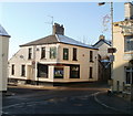
The Lewis Arms, Tongwynlais
Large pub in the centre of the village, on the corner of Merthyr Road and Mill Road. Named after a once-prominent family in the area. There is another Lewis Arms http://www.geograph.org.uk/photo/389992 a few kilometres away.
The pub sign http://www.geograph.org.uk/photo/2181252 shows the Lewis family coat of arms.
Image: © Jaggery
Taken: 29 Nov 2010
0.01 miles
4
Heraldic pub sign, The Lewis Arms, Tongwynlais
The pub sign of The Lewis Arms http://www.geograph.org.uk/photo/2181220 is the elaborate coat of arms of the Lewis family, once prominent in the area. The Welsh motto Ofner na ofne angau translates as 'Fear him who does not fear death'
Image: © Jaggery
Taken: 29 Nov 2010
0.01 miles
5
Tongwynlais RFC social club
The club is on the corner of Merthyr Road and Market Street, opposite The Lewis Arms. http://www.geograph.org.uk/photo/2181220
Tongwynlais RFC (Rugby Football Club) was founded in the 1890s. The club currently (season 2010-2011) plays in the Cardiff and District League, Premier Division.
Image: © Jaggery
Taken: 29 Nov 2010
0.01 miles
6
NW edge of Tongwynlais
The A4054 (Merthyr Road) reaches Tongwynlais, a village with a population of about 2,000. Formerly part of the county borough of Taff Ely, (later renamed Rhondda Cynon Taf), Tongwynlais has been absorbed into the City and County of Cardiff. It is in Cardiff North Rural Area.
Image: © Jaggery
Taken: 29 Nov 2010
0.05 miles
7
The Lewis Arms inn
Part of Castell Coch is visible to the right of the inn. There are traffic calming measures in the village; here the road narrows at the pedestrian crossing.
Image: © David Smith
Taken: 7 Jul 2011
0.06 miles
8
The Lewis Arms inn, Tongwynlais
Image: © David Smith
Taken: 19 Sep 2022
0.06 miles
9
The Lewis Arms, Tongwynlais,
Image: © Roger Cornfoot
Taken: 4 Aug 2021
0.06 miles
10
The Lewis Arms near Castle Coch
Image: © Ivan Hall
Taken: 26 Feb 2012
0.06 miles


