1
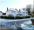
West side of Greenmeadow Drive, Tongwynlais
Viewed from the corner of Pantgwynlais (a residential road). In the background is Greenmeadow Wood.
Image: © Jaggery
Taken: 29 Nov 2010
0.04 miles
2
Pantgwynlais, Tongwynlais
Houses on the north side of the road, viewed from the corner of Cae Lewis. There are no houses on the southern side of this (western) part of Pantgwynlais. A row of trees shields the houses from traffic on Merthyr Road. There are houses on the south side at the eastern end of Pantgwynlais.
Image: © Jaggery
Taken: 29 Nov 2010
0.05 miles
3
Ordnance Survey Cut Mark
This OS cut mark can be found on the school wall. It marks a point 38.505m above mean sea level.
Image: © Adrian Dust
Taken: 20 Jul 2020
0.07 miles
4
Ordnance Survey Flush Bracket (S9242)
This OS Flush Bracket can be found on the north face of the school. It marks a point 36.868m above mean sea level.
Image: © Adrian Dust
Taken: 20 Jul 2020
0.08 miles
5
Edge of Greenmeadow Wood, Tongwynlais
The view from the Pantgwynlais (a residential road) along Greenmeadow Drive towards Greenmeadow Wood.
Image: © Jaggery
Taken: 29 Nov 2010
0.09 miles
6
Cae Lewis, Tongwynlais
Image: © Roger Cornfoot
Taken: 4 Aug 2021
0.09 miles
7
Tongwynlais Community Primary School
Viewed across Merthyr Road. The school, dating from 1908, occupies a site on the corner of Merthyr Road and Iron Bridge Road. The school motto is Llwyddiant I Bawb - Success For All.
Image: © Jaggery
Taken: 29 Nov 2010
0.11 miles
8
Northern end of Iron Bridge Road, Tongwynlais
Houses on the east side of the road, viewed from Merthyr Road. The west side of the road is here occupied by a primary school. http://www.geograph.org.uk/photo/2181741
Image: © Jaggery
Taken: 29 Nov 2010
0.11 miles
9
Traffic calming near the school
The school is behind the wall on the left; traffic is slowed to cross the pedestrian crossing with a priority system.
Image: © David Smith
Taken: 7 Jul 2011
0.11 miles
10
Castle View, Tongwynlais
Houses at the western end of Castle View, on the corner of Pantgwynlais (a residential road).
Image: © Jaggery
Taken: 29 Nov 2010
0.13 miles


