
IMAGES TAKEN NEAR TO
Park Road, CARDIFF, CF14 7BF
Introduction
This page details the photographs taken nearby to Park Road, CF14 7BF by members of the Geograph project.
The Geograph project started in 2005 with the aim of publishing, organising and preserving representative images for every square kilometre of Great Britain, Ireland and the Isle of Man.

There are currently over 7.5m images from over14,400 individuals and you can help contribute to the project by visiting https://www.geograph.org.uk
Image Map
Images are licensed for reuse under creativecommons.org/licenses/by-sa/2.0
Notes
- Clicking on the map will re-center to the selected point.
- The higher the marker number, the further away the image location is from the centre of the postcode.
Image Listing (59 Images Found)
Images are licensed for reuse under creativecommons.org/licenses/by-sa/2.0
Image
Details
Distance
1
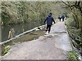
Canal overflow
The canal bank has been breached and the water is spilling over into the Melingruffydd feeder. Sandbags are proving to be barely adequate stepping stones.
Image: © Alan Hughes
Taken: 11 Feb 2021
0.04 miles
2
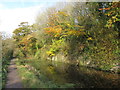
Glamorganshire Canal, Whitchurch, Cardiff
On the right is the site of Sunny Bank cottages.
Image: © Gareth James
Taken: 13 Nov 2011
0.05 miles
3
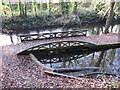
Sunny Bank Weir Bridge, Glamorganshire Canal, Cardiff
The canal is nearer the camera, with the Mellingriffith Feeder on the other side of the tow path. The bridge - dating from 1851 - had the side near the canal curved to allow the ropes of horse-drawn barges to pass over it.
Image: © Gareth James
Taken: 13 Nov 2011
0.06 miles
5
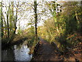
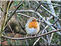
Waterways in Whitchurch, Cardiff
Near the southern entrance of the Forest Farm nature, we have the Melingriffith Feeder on the left, and one of the few remaining sections of the Glamorganshire Canal on the right. The Sunny Bank Weir bridge dates from 1851, and one side of it is rounded, to allow the tow ropes of horse-drawn barges to be pulled over easily.
Image: © Gareth James
Taken: 13 Nov 2011
0.07 miles
6
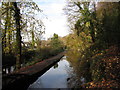
Glamorganshire Canal, Whitchurch, Cardiff
Image: © Gareth James
Taken: 13 Nov 2011
0.07 miles
7
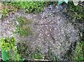
Ordnance Survey Cut Mark
This OS cut mark can be found on the low wall SE side of the path. It marks a point 41.672m above mean sea level.
Image: © Adrian Dust
Taken: 18 Nov 2018
0.08 miles
8
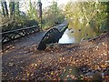
Glamorganshire Canal
Today, this is the end of the Glamorganshire Canal and all excess water flows under this bridge into the Melingriffith feeder on the left.
Formerly, the canal continued southwards from this point and just any excess water flowed into the feeder.
The feeder was constructed to supply the Melingriffith Tinplate Works that were built in 1749 and predates the canal built in the 1790s.
Image: © Robin Drayton
Taken: 17 Nov 2011
0.08 miles
9
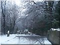
Southern entrance to the Glamorganshire Canal Local Nature Reserve
Taken after heavy snowfall - the snow on the trees make it look especially wintry. The vehicle tracks show that not everyone follows the official advice to only make essential journeys in this weather!
Image: © John Light
Taken: 13 Jan 2010
0.09 miles
10
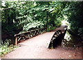
Camlas Morgannwg / Glamorgan Canal
Pont ar lan Camlas Morgannwg.
A bridge on the bank of the Glamorgan Canal.
Image: © Alan Richards
Taken: 28 Jul 1998
0.10 miles