Waterways in Whitchurch, Cardiff
Introduction
The photograph on this page of Waterways in Whitchurch, Cardiff by Gareth James as part of the Geograph project.
The Geograph project started in 2005 with the aim of publishing, organising and preserving representative images for every square kilometre of Great Britain, Ireland and the Isle of Man.

There are currently over 7.5m images from over 14,400 individuals and you can help contribute to the project by visiting https://www.geograph.org.uk
Waterways in Whitchurch, Cardiff
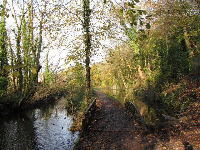
Image: © Gareth James Taken: 13 Nov 2011
Near the southern entrance of the Forest Farm nature, we have the Melingriffith Feeder on the left, and one of the few remaining sections of the Glamorganshire Canal on the right. The Sunny Bank Weir bridge dates from 1851, and one side of it is rounded, to allow the tow ropes of horse-drawn barges to be pulled over easily.
Images are licensed for reuse under creativecommons.org/licenses/by-sa/2.0
Image Location
Latitude
51.51645
Longitude
-3.236178