Glamorganshire Canal
Introduction
The photograph on this page of Glamorganshire Canal by Robin Drayton as part of the Geograph project.
The Geograph project started in 2005 with the aim of publishing, organising and preserving representative images for every square kilometre of Great Britain, Ireland and the Isle of Man.

There are currently over 7.5m images from over 14,400 individuals and you can help contribute to the project by visiting https://www.geograph.org.uk
Glamorganshire Canal
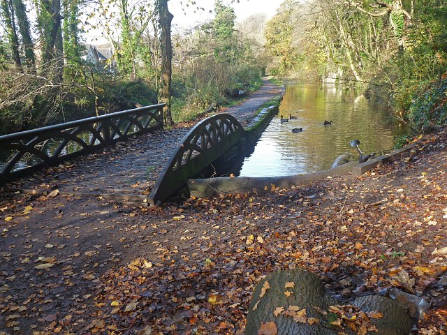
Image: © Robin Drayton Taken: 17 Nov 2011
Today, this is the end of the Glamorganshire Canal and all excess water flows under this bridge into the Melingriffith feeder on the left. Formerly, the canal continued southwards from this point and just any excess water flowed into the feeder. The feeder was constructed to supply the Melingriffith Tinplate Works that were built in 1749 and predates the canal built in the 1790s.
Images are licensed for reuse under creativecommons.org/licenses/by-sa/2.0
Image Location
Latitude
51.516272
Longitude
-3.236029