IMAGES TAKEN NEAR TO
Haverhill Road, HAVERHILL, CB9 7DN

Introduction

This page details the photographs taken nearby to Haverhill Road, CB9 7DN by members of the Geograph project.

The Geograph project started in 2005 with the aim of publishing, organising and preserving representative images for every square kilometre of Great Britain, Ireland and the Isle of Man.

There are currently over 7.5m images from over14,400 individuals and you can help contribute to the project by visiting https://www.geograph.org.uk

Image Map


Images are licensed for reuse under creativecommons.org/licenses/by-sa/2.0
Notes
  • Clicking on the map will re-center to the selected point.
  • The higher the marker number, the further away the image location is from the centre of the postcode.

Image Listing (20 Images Found)

Images are licensed for reuse under creativecommons.org/licenses/by-sa/2.0
Image
Details
Distance
1
Children's Playground in Steeple Bumpstead
Image: © Bikeboy Taken: 6 Jun 2012
0.08 miles
2
Former school house, Steeple Bumpstead
Image: © Roger Cornfoot Taken: 19 Jun 2011
0.11 miles
3
Junction at Steeple Bumpstead
Image: © Bikeboy Taken: 6 Jun 2012
0.12 miles
4
Road junction, Steeple Bumpstead
Image: © Roger Cornfoot Taken: 19 Jun 2011
0.14 miles
5
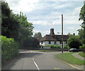
B1054 passes Clay Wall House
In the apex of the junction between the B1054 - Blois Road - and the B1057 - Chapel Street - lies Clay Wall House. Parts of it have been there since around 1600 and it is now Grade II listed with English Heritage Building ID: 114212. In base of the prominent main chimney-stack there are 2 recessed panels, with the date 1614 inscribed in modern plaster. It has 4 octagonal shafts, but has been rebuilt at the top.
Image: © Stuart Logan Taken: 28 Jun 2013
0.14 miles
6
Houses on Blois Road, Steeple Bumpstead
Image: © David Howard Taken: 18 Apr 2017
0.14 miles
7
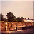
Steeple Bumpstead, Essex
This picture was taken in 1975 during a very hot dry summer the canalised stream at the side of the B1057 had dried up almost totally. According to the 1940's map this point in the road was a ford!
Image: © Glyn Baker Taken: Unknown
0.17 miles
8
Slush
The snow no longer magical after a few cars had passed by. This is the junction of Claywall bridge and North street. The road leading into the distance goes to Haverill.
Image: © Linda Taken: 1 Dec 2005
0.17 miles
9
B1054 passes the Jet Garage
The road is also called North Street.
Image: © Stuart Logan Taken: 28 Jun 2013
0.18 miles
10
Chapel Street, Steeple Bumpstead
Image: © Robin Webster Taken: 3 Jun 2018
0.18 miles