
IMAGES TAKEN NEAR TO
Shipp's Field, CAMBRIDGE, CB25 9DZ
Introduction
This page details the photographs taken nearby to Shipp's Field, CB25 9DZ by members of the Geograph project.
The Geograph project started in 2005 with the aim of publishing, organising and preserving representative images for every square kilometre of Great Britain, Ireland and the Isle of Man.

There are currently over 7.5m images from over14,400 individuals and you can help contribute to the project by visiting https://www.geograph.org.uk
Image Map
Images are licensed for reuse under creativecommons.org/licenses/by-sa/2.0
Notes
- Clicking on the map will re-center to the selected point.
- The higher the marker number, the further away the image location is from the centre of the postcode.
Image Listing (56 Images Found)
Images are licensed for reuse under creativecommons.org/licenses/by-sa/2.0
Image
Details
Distance
1
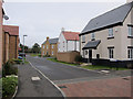
Shipps Field
Part of a new area of housing on the edge of Waterbeach. Beyond is Waterbeach Barracks, which is to be sold off for housing by 2015, so this may soon be closer to the middle rather than edge of Waterbeach.
Image: © Hugh Venables
Taken: 18 Mar 2012
0.02 miles
2
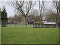
Waterbeach Barracks
The barracks, home to 39 Engineer Regiment, is to close by 2015 and be sold off for housing.
Image: © Hugh Venables
Taken: 18 Mar 2012
0.04 miles
3
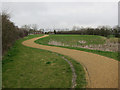
Path by new housing
Along the drainage area.
Image: © Hugh Venables
Taken: 18 Mar 2012
0.06 miles
4
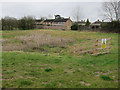
Drainage area by new housing
Damp area to take runoff from the new development Image
Image: © Hugh Venables
Taken: 18 Mar 2012
0.08 miles
5

Junction of Levitt Lane and Bannold Road in Waterbeach
Image: © Katie
Taken: 30 Nov 2018
0.10 miles
6
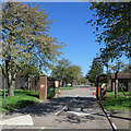
The entrance to Waterbeach Barracks
The former barracks (originally an RAF station) is to be developed as a new town. According to the developers' website "Waterbeach is the best brownfield site in the country. Three miles from the Cambridge Science Park with some of the most dynamic employment in the world, the development of Waterbeach will meet a demonstrable shortage of accessible accommodation in the north of the city, both from an expanding workforce and local residents who have lived here for generations."
Image: © John Sutton
Taken: 1 May 2018
0.11 miles
7
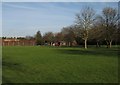
The entrance to Waterbeach Barracks
An RAF station from 1940-66 and a base for engineering regiments since, Waterbeach Barracks is due to close entirely in March 2013. The Hawker Hunter has been removed since Keith Edkins took Image] in January 2008.
Image: © John Sutton
Taken: 15 Dec 2012
0.12 miles
8
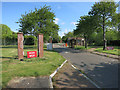
Waterbeach Barracks entrance
Now closed, with plans for a new town on the site.
Image: © Hugh Venables
Taken: 17 May 2015
0.12 miles
9
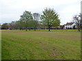
Grassed area outside the former barracks in Waterbeach
Image: © Richard Humphrey
Taken: 24 Apr 2016
0.12 miles
10
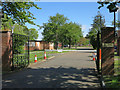
Waterbeach Barracks entrance
Now closed, with plans for a new town on the site.
Image: © Hugh Venables
Taken: 17 May 2015
0.12 miles