
IMAGES TAKEN NEAR TO
The Row, CAMBRIDGE, CB21 4NY
Introduction
This page details the photographs taken nearby to The Row, CB21 4NY by members of the Geograph project.
The Geograph project started in 2005 with the aim of publishing, organising and preserving representative images for every square kilometre of Great Britain, Ireland and the Isle of Man.

There are currently over 7.5m images from over14,400 individuals and you can help contribute to the project by visiting https://www.geograph.org.uk
Image Map
Images are licensed for reuse under creativecommons.org/licenses/by-sa/2.0
Notes
- Clicking on the map will re-center to the selected point.
- The higher the marker number, the further away the image location is from the centre of the postcode.
Image Listing (60 Images Found)
Images are licensed for reuse under creativecommons.org/licenses/by-sa/2.0
Image
Details
Distance
1

The King's Head Pub, Hadstock
The building dates from C17. See http://www.britishlistedbuildings.co.uk/en-405315-the-kings-head-inn-hadstock-essex for entry in British Listed Buildings
Image: © Bikeboy
Taken: 31 May 2013
0.04 miles
2
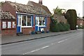
Former Hadstock Post Office And Stores
The former Hadstock Post Office and stores A 2011 photo recreating the same image as taken in 1986 for the Domesday project see http://www.bbc.co.uk/history/domesday/dblock/GB-552000-243000/picture/4
Image: © Keith Evans
Taken: 12 May 2011
0.05 miles
4

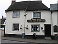
The Kings Head, Hadstock
A grade II listed building, 17th century with later alterations.
Image: © Robin Webster
Taken: 3 Oct 2015
0.08 miles
5
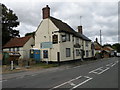
The King's Head, Hadstock
Currently closed. The community pub venture, whose banner appear on the building, was outbid. As of 2016 it was hoped the new owners would be re-opening it, but this evidently hasn't happened yet. The building is C17 timber-framed and plastered, altered in the C18 and later. Grade II listed.
In happier days (2013): Image
Image: © Keith Edkins
Taken: 13 Sep 2017
0.08 miles
6
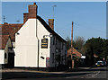
Hadstock: The King's Head
The photo title restores the apostrophe the signwriter eschewed.
Image: © John Sutton
Taken: 8 Feb 2011
0.09 miles
7
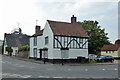
Kings Cottage, Hadstock
A grade II listed building, 15th century but much altered from the 17th century onwards.
Image: © Robin Webster
Taken: 3 Oct 2015
0.09 miles
8

Houses near road junction in Hadstock
The near road is the B1052 which passes through the village. The houses which feature mainly in the image have gambrel roofs; roofs which slope at two separate angles. (Note: Gambrel roofs (apparently) have vertical gables whereas a mansard roof has the double slope feature on all sides.)
Image: © Trevor Littlewood
Taken: 10 Oct 2014
0.10 miles
9

Len's Path
Horses, vehicles and motorbikes are strictly banned, the parish council notice warns. Len's Path is a safe field-edge route from Linton to Hadstock, avoiding the blind bends of the B1052, a sunken lane at this point. Linton Water Tower is on the left horizon, two miles away.
Image: © John Sutton
Taken: 8 Feb 2011
0.10 miles
10

Walnut Cottage, Hadstock
C18 timber-framed, plastered and thatched cottage, renovated in the C20. Grade II listed
Image: © Keith Edkins
Taken: 13 Sep 2017
0.10 miles