The King's Head, Hadstock
Introduction
The photograph on this page of The King's Head, Hadstock by Keith Edkins as part of the Geograph project.
The Geograph project started in 2005 with the aim of publishing, organising and preserving representative images for every square kilometre of Great Britain, Ireland and the Isle of Man.

There are currently over 7.5m images from over 14,400 individuals and you can help contribute to the project by visiting https://www.geograph.org.uk
The King's Head, Hadstock
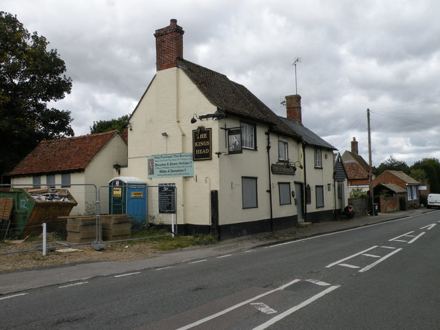
Image: © Keith Edkins Taken: 13 Sep 2017
Currently closed. The community pub venture, whose banner appear on the building, was outbid. As of 2016 it was hoped the new owners would be re-opening it, but this evidently hasn't happened yet. The building is C17 timber-framed and plastered, altered in the C18 and later. Grade II listed. In happier days (2013): Image
Images are licensed for reuse under creativecommons.org/licenses/by-sa/2.0
Image Location


Leaflet Map data © OpenStreetMap
Latitude
52.080513
Longitude
0.273524