IMAGES TAKEN NEAR TO
Banks, BRAMPTON, CA8 2BX
Introduction
This page details the photographs taken nearby to CA8 2BX by members of the Geograph project.
The Geograph project started in 2005 with the aim of publishing, organising and preserving representative images for every square kilometre of Great Britain, Ireland and the Isle of Man.

There are currently over 7.5m images from over14,400 individuals and you can help contribute to the project by visiting https://www.geograph.org.uk
Image Map
Images are licensed for reuse under creativecommons.org/licenses/by-sa/2.0
Notes
- Clicking on the map will re-center to the selected point.
- The higher the marker number, the further away the image location is from the centre of the postcode.
Image Listing (35 Images Found)
Images are licensed for reuse under creativecommons.org/licenses/by-sa/2.0
Image
Details
Distance
1
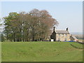
The north defensive ditch of Hadrian's Wall at Leahill
Image: © Mike Quinn
Taken: 20 Apr 2009
0.02 miles
2
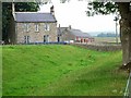
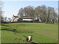
Leahill Farm
The north defensive ditch associated with the Roman Wall can be clearly seen.
Image: © Oliver Dixon
Taken: 20 Jul 2006
0.02 miles
4
The north defensive ditch of Hadrian's Wall east of Leahill
Image: © Mike Quinn
Taken: 20 Apr 2009
0.05 miles
5
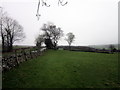
The north defensive ditch of Hadrian's Wall west of Turret 51b (Lea Hill)
Looking west towards Image (photo by Oliver Dixon).
Image: © Mike Quinn
Taken: 20 Apr 2009
0.05 miles
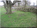
7
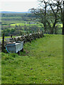
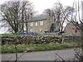
Instead of Hadrian's Wall, a Cattle Trough
Image: © Mick Garratt
Taken: 25 Apr 2024
0.06 miles
8
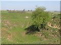
Disused quarry west of Leahill
The line of the north defensive ditch of Hadrian's Wall runs (left to right) through the quarry; the Wall itself lies under the minor road from Banks to Birdoswald.
Image: © Mike Quinn
Taken: 20 Apr 2009
0.08 miles
9
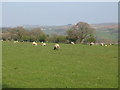
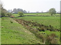
Pastures east of Bankshead above the River Irthing (4)
Image: © Mike Quinn
Taken: 20 Apr 2009
0.08 miles
10
Site of Turret 51b, Hadrian's Wall near Leahill
Image: © Les Hull
Taken: 7 Apr 2010
0.08 miles