
IMAGES TAKEN NEAR TO
Cargo, CARLISLE, CA6 4BE
Introduction
This page details the photographs taken nearby to CA6 4BE by members of the Geograph project.
The Geograph project started in 2005 with the aim of publishing, organising and preserving representative images for every square kilometre of Great Britain, Ireland and the Isle of Man.

There are currently over 7.5m images from over14,400 individuals and you can help contribute to the project by visiting https://www.geograph.org.uk
Image Map
Images are licensed for reuse under creativecommons.org/licenses/by-sa/2.0
Notes
- Clicking on the map will re-center to the selected point.
- The higher the marker number, the further away the image location is from the centre of the postcode.
Image Listing (7 Images Found)
Images are licensed for reuse under creativecommons.org/licenses/by-sa/2.0
Image
Details
Distance
1
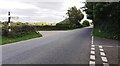
T-junction at Cargo
There is a Cumberland County Council finger signpost Image on the verge on the left hand side of the road
Image: © Roger Templeman
Taken: 17 Aug 2021
0.03 miles
2
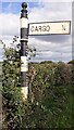
Cumberland County Council signpost
The signpost has Milestone Society National ID: CU_NY3659
Image: © Roger Templeman
Taken: 17 Aug 2021
0.06 miles
3
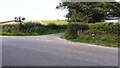
Road junction at St Owens sign
There is an Ordnance Survey benchmark Image on the gatepost in the hedge at the right hand corner of the junction. The mark at the base of the stone in a white patch of lichen
Image: © Roger Templeman
Taken: 17 Aug 2021
0.07 miles
4

Benchmark on stone post on NE side of road at St Owens junction
Ordnance Survey cut mark benchmark leveelled at 14.962m above Newlyn Datum verified 1974
Image: © Roger Templeman
Taken: 17 Aug 2021
0.07 miles
5
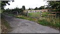
Field gateway and gated road near St Owens
Ordnance Survey records indicate that a benchmark levelled at 14.930m above Newlyn Datum was verified in 1954 on top of a gatepost at this field gateway which has evidently been widened and gateposts replaced
Image: © Roger Templeman
Taken: 17 Aug 2021
0.15 miles
6
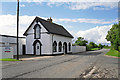
Chapel Cottage
This crisply painted black and white house has a datestone on the gable at the other end - see Image .
It certainly looks like a converted chapel, but we couldn't find any information about the history of the building.
Chapel Cottage is in a small cluster of houses on the Kingmoor to Rockcliffe road, which is marked on maps as Chapel House (previously Chapelhouse) - perhaps the location is named after it.
Image: © Rose and Trev Clough
Taken: 31 Aug 2016
0.25 miles
7

Chapel Cottage, 1850
Datestone on building shown here Image .
Image: © Rose and Trev Clough
Taken: 31 Aug 2016
0.25 miles