Chapel Cottage
Introduction
The photograph on this page of Chapel Cottage by Rose and Trev Clough as part of the Geograph project.
The Geograph project started in 2005 with the aim of publishing, organising and preserving representative images for every square kilometre of Great Britain, Ireland and the Isle of Man.

There are currently over 7.5m images from over 14,400 individuals and you can help contribute to the project by visiting https://www.geograph.org.uk
Chapel Cottage
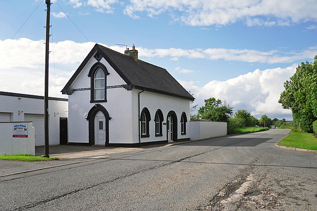
Image: © Rose and Trev Clough Taken: 31 Aug 2016
This crisply painted black and white house has a datestone on the gable at the other end - see Image . It certainly looks like a converted chapel, but we couldn't find any information about the history of the building. Chapel Cottage is in a small cluster of houses on the Kingmoor to Rockcliffe road, which is marked on maps as Chapel House (previously Chapelhouse) - perhaps the location is named after it.
Images are licensed for reuse under creativecommons.org/licenses/by-sa/2.0
Image Location
Latitude
54.925949
Longitude
-2.98129