IMAGES TAKEN NEAR TO
Kingstown Road, CARLISLE, CA3 0DE
Introduction
This page details the photographs taken nearby to Kingstown Road, CA3 0DE by members of the Geograph project.
The Geograph project started in 2005 with the aim of publishing, organising and preserving representative images for every square kilometre of Great Britain, Ireland and the Isle of Man.

There are currently over 7.5m images from over14,400 individuals and you can help contribute to the project by visiting https://www.geograph.org.uk
Image Map
Images are licensed for reuse under creativecommons.org/licenses/by-sa/2.0
Notes
- Clicking on the map will re-center to the selected point.
- The higher the marker number, the further away the image location is from the centre of the postcode.
Image Listing (44 Images Found)
Images are licensed for reuse under creativecommons.org/licenses/by-sa/2.0
Image
Details
Distance
2
"Coach & Horses", Kingstown Road - January 2017 (3)
For information on this building, see: Image] .
Image: © The Carlisle Kid
Taken: 26 Jan 2017
0.02 miles
3
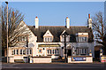
"Coach & Horses", Kingstown Road - January 2017 (2)
For information on this building, see: Image] .
Image: © The Carlisle Kid
Taken: 26 Jan 2017
0.02 miles
4
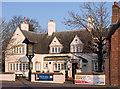
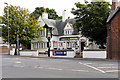
"Coach & Horses", Kingstown Road - January 2017 (1)
Designed by Harry Redfern, the "Coach & Horses" opened on 10 August 1929. Built by J & R Bell at a cost of £4,523, it replaced an old pub of the same name with additional space obtained through the demolition of two adjoining cottages. Sold to John Smiths Brewery Group in May 1973, the pub is still trading.
For additional views, see: Image] and Image] .
Photograph is for record only - I have no connection with any business seen in this view and cannot advise on their products or services.
Image: © The Carlisle Kid
Taken: 26 Jan 2017
0.02 miles
5
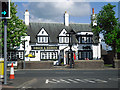
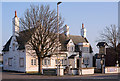
The Coach and Horses, Kingstown
One of several pubs in the Carlisle district designed by Harry Redfern, chief architect for the State Management Scheme (government control of alcohol - see Wikipedia http://en.wikipedia.org/wiki/State_Management_Scheme ).
The Coach and Horses was built in 1929 (Carlisle Encyclopaedia http://www.carlisleshistory.co.uk/page24.htm ).
Image: © Rose and Trev Clough
Taken: 26 May 2013
0.02 miles
6
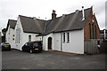
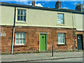
St Peter's School, Kingstown Road
Now houses a supplier of gas and electric fires and fireplaces. There is probably an Ordnance Survey flush bracket benchmark (see http://www.bench-marks.org.uk/bm10282 for details) on the brick face of the building behind the wooden lean-to.
Image: © Roger Templeman
Taken: 18 Jul 2015
0.03 miles
7
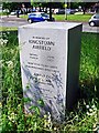
Memorial marker stone for Kingstown Airfield
Carlisle's first municipal airport was located at Kingstown, on land now occupied by Kingstown Industrial Estate. It was officially opened in 1934, and closed in 1957.
The stone was unveiled in 2011 - it is one of many erected across the country by the Airfields of Britain Conservation Trust. Their website provides information about the history of aviation at Kingstown http://www.abct.org.uk/airfields/airfield-finder/kingstown-carlisle/# .
Image: © Rose and Trev Clough
Taken: 19 May 2014
0.04 miles
8
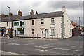
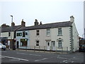
Buildings at Kingstown Road / California Road junction
The buildings include Kingstown Post Office, Newsagents, gun shop and #252 Kingstown Road. The building at the junction is shown on Old-Maps as a pub, with an 1844 Ordnance Survey benchmark described on the Bench Mark Database at http://www.bench-marks.org.uk/bm38791
Image: © Roger Templeman
Taken: 18 Jul 2015
0.05 miles