IMAGES TAKEN NEAR TO
Hutton Roof, PENRITH, CA11 0XS
Introduction
This page details the photographs taken nearby to CA11 0XS by members of the Geograph project.
The Geograph project started in 2005 with the aim of publishing, organising and preserving representative images for every square kilometre of Great Britain, Ireland and the Isle of Man.

There are currently over 7.5m images from over14,400 individuals and you can help contribute to the project by visiting https://www.geograph.org.uk
Image Map
Images are licensed for reuse under creativecommons.org/licenses/by-sa/2.0
Notes
- Clicking on the map will re-center to the selected point.
- The higher the marker number, the further away the image location is from the centre of the postcode.
Image Listing (8 Images Found)
Images are licensed for reuse under creativecommons.org/licenses/by-sa/2.0
Image
Details
Distance
1

In Hutton Roof
This, now a private house, is presumably the former pub which is still marked on the OS maps. At least, I could find no other likely contender in this very small village.
Image: © David Purchase
Taken: 5 Sep 2011
0.05 miles
2

The lane through Hutton Roof, Mungrisdale CP
Wham Head Farm is behind the trees.
Image: © Humphrey Bolton
Taken: 1 Nov 2006
0.05 miles
3

Trees alongside minor road
The road leaves the tiny settlement of Hutton Roof heading north-east towards the Lake District National Park boundary.
Image: © Trevor Littlewood
Taken: 18 Nov 2018
0.12 miles
4

Hutton Roof Farm
Hutton Roof Farm at Hutton Roof.
Image: © Peter McDermott
Taken: 15 Nov 2011
0.16 miles

6

Hutton Roof
Road beneath Hutton Roof.
Image: © Peter McDermott
Taken: 15 Nov 2011
0.22 miles
7

The footpath from Hutton Roof to Low Mill
Judging by appearances, this footpath is not much used.
Image: © David Purchase
Taken: 5 Sep 2011
0.24 miles
8
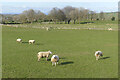
Pasture, Mungrisdale
Sheep grazing to the north of Hutton Roof.
Image: © Andrew Smith
Taken: 31 Mar 2024
0.25 miles