IMAGES TAKEN NEAR TO
Osborne Park, BELFAST, BT9 6JP

Introduction

This page details the photographs taken nearby to Osborne Park, BT9 6JP by members of the Geograph project.

The Geograph project started in 2005 with the aim of publishing, organising and preserving representative images for every square kilometre of Great Britain, Ireland and the Isle of Man.

There are currently over 7.5m images from over14,400 individuals and you can help contribute to the project by visiting https://www.geograph.org.uk

Image Map


Images are licensed for reuse under creativecommons.org/licenses/by-sa/2.0
Notes
  • Clicking on the map will re-center to the selected point.
  • The higher the marker number, the further away the image location is from the centre of the postcode.

Image Listing (38 Images Found)

Images are licensed for reuse under creativecommons.org/licenses/by-sa/2.0
  • ...
Image
Details
Distance
1
Postbox, Belfast
George V postbox on Maryville Park in Belfast.
Image: © Rossographer Taken: 8 Mar 2010
0.07 miles
2
Postbox, Belfast
George V postbox on Myrtlefield Park Image in Belfast.
Image: © Rossographer Taken: 23 Mar 2010
0.08 miles
3
Maryville Park, Belfast
Street running from the Lisburn Road to the Malone Road. Mainly developed in the 1920s and 1930s with some Victorian period properties close to the junction with the Lisburn Road.
Image: © Rossographer Taken: 8 Mar 2010
0.08 miles
4
Snow in Belfast [13]
Another view down Osborne Park at about 9:10am. See also Image
Image: © Rossographer Taken: 4 Jan 2008
0.10 miles
5
Myrtlefield Park, Belfast
Another fine avenue that runs between the Lisburn and Malone roads in south Belfast.
Image: © Rossographer Taken: 23 Mar 2010
0.11 miles
6
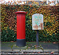
Postbox, Belfast
Postbox on Osborne Gardens in Belfast, alongside a 'drop box' for the postie on his/her rounds. Slightly unusual positioning with this one as the aperture faces the hedge and distance from box to hedge is about 50cm. This makes posting anything or emptying the box quite awkward and taking a picture of the front virtually impossible. For the record it is a George V box.
Image: © Rossographer Taken: 17 Nov 2009
0.12 miles
7
Suburban crossroads, Belfast
Crossroads in the heart of suburbia, between the Malone and Lisburn Roads. Osborne Gardens runs ahead. The Bawnmore Road (not to be confused with the Bawnmore estate) runs across,
Image: © Albert Bridge Taken: 13 Jan 2011
0.14 miles
8
Cranmore House
The ruins of John Templeton's house; there was a fine garden here too in the early 1800s. Templeton was an important figure in Belfast's intellectual life in the early nineteenth century.
Image: © Dr Charles Nelson Taken: Unknown
0.16 miles
9
Drain cover, Belfast
Drainage cover on a footpath at Lancefield Road off the Lisburn Road in Belfast. It bears the name "Joseph Blair, Church Lane, Belfast". Joseph Blair was formed in 1903 as a "plumbing, heating and hardware merchant"; the company is still operating today under the name of Macnaughton Blair Limited (MB Architectural http://www.mbarchitectural.com/ - this followed a merger with Norman MacNaughton Ltd. Image c1972, both firms having been owned by Blue Circle http://en.wikipedia.org/wiki/Blue_Circle_Industries . ) and is based in Falcon Road, Belfast. See also Image for another example from the same street.
Image: © Rossographer Taken: 18 May 2010
0.16 miles
10
Snow in Belfast [9]
Looking down Osborne Park at about 9:00am. See also Image
Image: © Rossographer Taken: 4 Jan 2008
0.17 miles
  • ...