IMAGES TAKEN NEAR TO
Rosepark Gardens, BELFAST, BT5 7WL
Introduction
This page details the photographs taken nearby to Rosepark Gardens, BT5 7WL by members of the Geograph project.
The Geograph project started in 2005 with the aim of publishing, organising and preserving representative images for every square kilometre of Great Britain, Ireland and the Isle of Man.

There are currently over 7.5m images from over14,400 individuals and you can help contribute to the project by visiting https://www.geograph.org.uk
Image Map
Images are licensed for reuse under creativecommons.org/licenses/by-sa/2.0
Notes
- Clicking on the map will re-center to the selected point.
- The higher the marker number, the further away the image location is from the centre of the postcode.
Image Listing (48 Images Found)
Images are licensed for reuse under creativecommons.org/licenses/by-sa/2.0
Image
Details
Distance
1
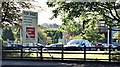
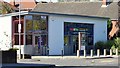
"For sale" sign, Rosepark House, Belfast (September 2015)
See Image A “for sale” sign facing the Upper Newtownards Road. The agents’ description includes “Offers invited in the region of £2,000,000 . . . . . . The site is bound by medium density residential housing to the South, East and West. A Maxol petrol filling station and Spar convenience store are located immediately adjacent to the site, also fronting Upper Newtownards Road. A two storey office building is situated in the middle of the site incorporating c.7,951 sq ft of accommodation.” This photograph appears as a matter of record only. I have no connection with the agents and cannot enter into correspondence.
Image: © Albert Bridge
Taken: 16 Sep 2015
0.01 miles
2
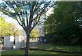
The entrance to Dundonald House
These are government buildings housing the Department of Health and Social Security and the Department of Agriculture.
Image: © Eric Jones
Taken: 21 May 2012
0.03 miles
3
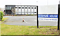
Rosepark House, Belfast - February 2015(2)
See Image The building is currently occupied by part of the Department of Finance and Personnel – soon to be re-named “Department of Finance”.
Image: © Albert Bridge
Taken: 28 Feb 2015
0.03 miles
4
Rosepark House, Belfast - February 2015(1)
A Government building, commonly called “Rosepark”, on the Upper Newtownards Road, built (I think) in the late 1960’s or early 1970’s, on what might have been the site of Dundonald telephone exchange. Originally in the form of a short-term building it was (much) later modernised to its present form. The name “Rosepark” comes from “Rose Park” a house (shown, on an old 25” map on the OSI website http://www.osi.ie/Home.aspx , approximately on the site of the present Dundonald House Image, on the other side of the road) owned by one of the Cleland family Image and Image See also Image Continue to Image
Image: © Albert Bridge
Taken: 28 Feb 2015
0.03 miles
5
Nos 697-699 Upper Newtownards Road, Belfast (September 2015)
The former First Trust Bank now converted, after extensive work, to a veterinary surgery. This photograph appears as a matter of record only. I have no connection with the business.
Image: © Albert Bridge
Taken: 16 Sep 2015
0.04 miles
6

Hotel sculpture, Belfast
At the entrance to the Hastings Stormont Hotel Image on the Upper Newtownards Road.
Image: © Albert Bridge
Taken: 23 Jan 2010
0.04 miles
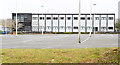
7
Rosepark House, Belfast (June 2016)
The prefabricated part of the building (right) has been removed.
Image: © Albert Bridge
Taken: 22 Jun 2016
0.04 miles
8
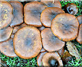
Fungi, Belfast - November 2014(5)
Part of a long growth (about 25 yards) of the same species of fungi, on the grass verge of the Upper Newtownards Road, opposite the Rosepark petrol station. For another example, nearby, see Image
Image: © Albert Bridge
Taken: 26 Nov 2014
0.05 miles
9

Fungi, Belfast - November 2014(6)
See Image Another, less tightly-packed example, nearby.
Image: © Albert Bridge
Taken: 26 Nov 2014
0.05 miles
10
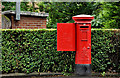
Pillar box, Belfast
GVIR pillar box, on the Upper Newtownards Road, close to Ardcarn Way. It has the postcode BT5 7RP and has the distinction of being the last Belfast box on the main road. The next one is BT16 0AB Image in Dundonald.
Image: © Albert Bridge
Taken: 2 Aug 2011
0.07 miles