1
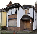
Thornhill Park, Belfast (2011)
The Upper Newtownards Road end of a suburban road running from Barnett’s Road
Image The Castlehill Road
Image is straight ahead. Stormont Presbyterian church
Image is on the right. Continue to
Image (August 2013).
Image: © Albert Bridge
Taken: 13 Dec 2011
0.02 miles
2
No 517 Upper Newtownards Road, Belfast (October 2014)
The “for sale” sign, at this long-vacant house, has been removed. The site of the former no 515 (right) is in the process of being tidied. Checking old street directories for the date of construction is not so easy. The houses have been renumbered following post-WW1 development but it seems likely to have been built after the construction of Parliament Buildings, Stormont - a time which saw the locality becoming popular with civil servants.
Image: © Albert Bridge
Taken: 25 Oct 2014
0.03 miles
3
Nos 515 & 517 Upper Newtownards Road, Belfast (2011-3)
No 515 now has two broken upstairs windows.
Image: © Albert Bridge
Taken: 13 Dec 2011
0.03 miles
4
Nos 515&517 Upper Newtownards Road, Belfast (2011-1)
The houses remain vacant and awaiting redevelopment.
Image: © Albert Bridge
Taken: 2 Aug 2011
0.03 miles
5
515 & 517 Upper Newtownards Road, Belfast (2010-1)
No 517 is on the left.
Image: © Albert Bridge
Taken: 23 Jan 2010
0.03 miles
6
Nos 515 & 517 Upper Newtownards Road, Belfast (2012)
No 515 occupied the site between 517 (left) and the shops. It was demolished a few days ago.
Image: © Albert Bridge
Taken: 13 May 2012
0.03 miles
7
Nos 515 & 517 Upper Newtownards Road, Belfast (2011-2)
In the four months since the last photograph no 517 (left) has received some attention from the vandals. The downstairs window (left) is broken and the door has been boarded up.
Image: © Albert Bridge
Taken: 13 Dec 2011
0.03 miles
8
No 517 Upper Newtownards Road, Belfast (2013-3)
The number on 517’s gate.
Image: © Albert Bridge
Taken: 12 Aug 2013
0.03 miles
9
No 517 Upper Newtownards Road, Belfast (2013-2)
The three chimney pots (all identical) on 517.
Image: © Albert Bridge
Taken: 12 Aug 2013
0.03 miles
10
No 517 Upper Newtownards Road, Belfast (2013-1)
No 515 has been demolished but 517 remains standing.
Image: © Albert Bridge
Taken: 12 Aug 2013
0.03 miles


