IMAGES TAKEN NEAR TO
Upper Road, CARRICKFERGUS, BT38 8PN

Introduction

This page details the photographs taken nearby to Upper Road, BT38 8PN by members of the Geograph project.

The Geograph project started in 2005 with the aim of publishing, organising and preserving representative images for every square kilometre of Great Britain, Ireland and the Isle of Man.

There are currently over 7.5m images from over14,400 individuals and you can help contribute to the project by visiting https://www.geograph.org.uk

Image Map


Images are licensed for reuse under creativecommons.org/licenses/by-sa/2.0
Notes
  • Clicking on the map will re-center to the selected point.
  • The higher the marker number, the further away the image location is from the centre of the postcode.

Image Listing (17 Images Found)

Images are licensed for reuse under creativecommons.org/licenses/by-sa/2.0
Image
Details
Distance
1
Railway near Trooperslane, Carrickfergus
See Image A few more fields – this time between Greenisland and Trooperslane. The 09.58 Belfast Gt Victoria Street – Carrickfergus is approaching Trooperslane station Image (out of picture to the left). The Upper Road (the back road to Carrickfergus) runs along the bottom of the photo. The view is from the war memorial at Knockagh Image
Image: © Albert Bridge Taken: 6 May 2010
0.11 miles
2
Letter box, Trooperslane, Carrickfergus
Post-mounted EIIR letter box, at the Upper Road end of Knockmore Park. There is another, not too far away, at the bottom of the road Image
Image: © Albert Bridge Taken: 9 Oct 2011
0.11 miles
3
Steam locomotive no 85, Trooperslane (April 2014)
See Image No 85, running tender-first, approaching Trooperslane station with the 11.00 Belfast Central – Whitehead “Easter Eggspress”.
Image: © Albert Bridge Taken: 22 Apr 2014
0.11 miles
4
Accommodation crossing XR 305, Trooperslane
Accommodation crossing XR 305 on the Belfast side of Trooperslane station – intended for use by the signalling and telecoms personnel. There is no public access. This photograph is from the Trooperslane Road, at the level crossing.
Image: © Albert Bridge Taken: 22 Apr 2014
0.12 miles
5
Trooperslane level crossing - April 2014(2)
Trooperslane level crossing with the full barriers lowered across the road.
Image: © Albert Bridge Taken: 22 Apr 2014
0.15 miles
6
Trooperslane level crossing - April 2014(1)
The 10.45 Belfast (Gt Victoria Street) – Whitehead (4015) crossing the Trooperslane Road and entering Trooperslane station (right). The road has become very busy during the closure of the Station Road/Shore Road junction, at Greenisland, during the building of the new dual carriageway Image
Image: © Albert Bridge Taken: 22 Apr 2014
0.15 miles
7
Trooperslane station, Carrickfergus (3)
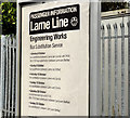
An information sign, on the up platform, giving dates of closures and part-closures to facilitate engineering work.
Image: © Albert Bridge Taken: 9 Oct 2011
0.16 miles
8
Trooperslane station, Carrickfergus (2)
Trooperslane station, looking towards Carrickfergus and Larne Harbour. The passenger shelter (right) replaced the original Berkeley Deane Wise building Image The platforms will probably be lengthened (as at Downshire Image) to accommodate new rolling stock. Image shows a similar view in 1979.
Image: © Albert Bridge Taken: 9 Oct 2011
0.18 miles
9
MPD railcars, Trooperslane station
The 11.20 Larne Harbour – Belfast York Road (composed of power cars nos 51, 65 and 64) is generating some black exhaust fumes as it climbs, non-stop, through Trooperslane station. Image shows a similar view almost 32 years later.
Image: © Albert Bridge Taken: 24 Nov 1979
0.18 miles
10
Trooperslane railway station
Trooperslane railway station was built in 1896 to a design by Berkeley Deane Wise, the eccentric Civil Engineer of the Belfast & Northern Counties Railway. Heavily vandalised after the withdrawal of staff, it was pulled-down in 1975 before listed building status could be applied. A very sad loss.
Image: © The Carlisle Kid Taken: Unknown
0.18 miles