Railway near Trooperslane, Carrickfergus
Introduction
The photograph on this page of Railway near Trooperslane, Carrickfergus by Albert Bridge as part of the Geograph project.
The Geograph project started in 2005 with the aim of publishing, organising and preserving representative images for every square kilometre of Great Britain, Ireland and the Isle of Man.

There are currently over 7.5m images from over 14,400 individuals and you can help contribute to the project by visiting https://www.geograph.org.uk
Railway near Trooperslane, Carrickfergus
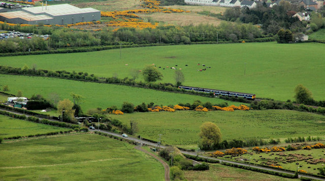
Image: © Albert Bridge Taken: 6 May 2010
See Image A few more fields – this time between Greenisland and Trooperslane. The 09.58 Belfast Gt Victoria Street – Carrickfergus is approaching Trooperslane station Image (out of picture to the left). The Upper Road (the back road to Carrickfergus) runs along the bottom of the photo. The view is from the war memorial at Knockagh Image
Images are licensed for reuse under creativecommons.org/licenses/by-sa/2.0
Image Location
Latitude
54.708549
Longitude
-5.852254