1
Development site, Carrickfergus (2)
Part of a site, between the Sloefield Road (foreground) and the Belfast Road. Described by the agent as “The subject property comprises a substantial portion of land extending from the Belfast Road in a north westerly direction and is approximately 0.5 miles from Carrickfergus town centre. Currently the site is approached via Sloefield Road and Priory Drive, although there is potential for a second access.
The subject site is a regular shaped portion of land which is largely in rough grass. The site forms part of the original Courtaulds Industrial complex and benefits from an extensive frontage to Belfast Road and uninterrupted views over Belfast Lough, beyond the road.
The site had currently benefited from planning permission for 39 detached bungalows. Application No. U/2001/0279/F. We are advised this permission was passed in 2003, therefore we recommend all parties to satisfy themselves to the validity with the Planning Service NI.
Total site area: 9.96 acres (4.03 hectares).”
This photograph appears as a matter of record only. I have no connection with the owner or the agent.
Image: © Albert Bridge
Taken: 1 Jul 2011
0.05 miles
2
Development site, Carrickfergus (1)
Part of a site, between the Sloefield Road (foreground) and the Belfast Road. Described by the agent as “The subject property comprises a substantial portion of land extending from the Belfast Road in a north westerly direction and is approximately 0.5 miles from Carrickfergus town centre. Currently the site is approached via Sloefield Road and Priory Drive, although there is potential for a second access.
The subject site is a regular shaped portion of land which is largely in rough grass. The site forms part of the original Courtaulds Industrial complex and benefits from an extensive frontage to Belfast Road and uninterrupted views over Belfast Lough, beyond the road.
The site had currently benefited from planning permission for 39 detached bungalows. Application No. U/2001/0279/F. We are advised this permission was passed in 2003, therefore we recommend all parties to satisfy themselves to the validity with the Planning Service NI.
Total site area: 9.96 acres (4.03 hectares).”
This photograph appears as a matter of record only. I have no connection with the owner or the agent.
Image: © Albert Bridge
Taken: 1 Jul 2011
0.08 miles
3
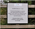
"No street trading" sign, Carrickfergus
A sign, warning against street trading, in the lay-by on the Belfast Road.
Image: © Albert Bridge
Taken: 1 Jul 2011
0.09 miles
4
40mph road markings, Carrickfergus (January 2017)
40 mph markings on the outward lanes of the Belfast Road near Trooperslane.
Image: © Albert Bridge
Taken: 29 Jan 2017
0.09 miles
5
Bus stop, Carrickfergus (January 2017)
A bus stop on the Belfast Road. Served by the outward Ulsterbus 163 Belfast – Carrickfergus/Kilroot/Whitehead buses.
Image: © Albert Bridge
Taken: 29 Jan 2017
0.09 miles
6
The Sloefield Road, Carrickfergus
A road, off the Belfast Road, through part of the site of the old Courtaulds factory
Image, built to open the site to mixed residential and commercial development. Technically it’s probably a “spine” road.
Image: © Albert Bridge
Taken: 1 Jul 2011
0.10 miles
7
The seawall, Carrickfergus (3)
Part of the seawall, near the Sloefield Road, showing navelwort growing in gaps in the concrete. The wall also had a colony of red spider mites http://en.wikipedia.org/wiki/Spider_mite.
Image: © Albert Bridge
Taken: 1 Jul 2011
0.12 miles
8
Approaching Carrickfergus
Dog walkers and traffic on the A2 Belfast Road.
Image: © Robert Ashby
Taken: 28 Oct 2015
0.13 miles
9
Former Courtaulds factory, Carrickfergus (2)
See
Image A remaining part of the former Courtaulds factory – facing the Belfast Road.
Image: © Albert Bridge
Taken: 1 Jul 2011
0.18 miles
10
Go petrol station, Carrickfergus (January 2017)
An unattended “pay at pump” petrol station at 87 Belfast Road.
Image: © Albert Bridge
Taken: 29 Jan 2017
0.19 miles


