IMAGES TAKEN NEAR TO
Mullartown Park, NEWRY, BT34 4QX
Introduction
This page details the photographs taken nearby to Mullartown Park, BT34 4QX by members of the Geograph project.
The Geograph project started in 2005 with the aim of publishing, organising and preserving representative images for every square kilometre of Great Britain, Ireland and the Isle of Man.

There are currently over 7.5m images from over14,400 individuals and you can help contribute to the project by visiting https://www.geograph.org.uk
Image Map
Images are licensed for reuse under creativecommons.org/licenses/by-sa/2.0
Notes
- Clicking on the map will re-center to the selected point.
- The higher the marker number, the further away the image location is from the centre of the postcode.
Image Listing (121 Images Found)
Images are licensed for reuse under creativecommons.org/licenses/by-sa/2.0
Image
Details
Distance
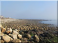
1
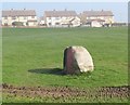
Turf marker north of the harbour at Annalong
The black and the red on the stone are the colours of the Down GAA teams which draw their supporter mainly from the Catholic community and in predominantly Loyalist Annalong and Kilkeel black and red is used by the residents of the Catholic estates, one which can be seen here in the background, to mark off what they consider to be their territory.
Image: © Eric Jones
Taken: 16 Mar 2011
0.05 miles
2
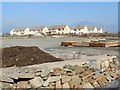
The site of a new car park at the Annalong Marine Park
Image: © Eric Jones
Taken: 16 Mar 2011
0.07 miles
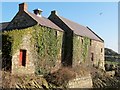
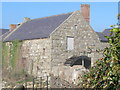
3
Temporarily boarded up buildings on the Annalong Marine Park site
The site is now undergoing redevelopment and expansion. These buildings are former warehouses.
http://www.fpmccann.co.uk/News/76/annalong-marine-park-and-cornmill.aspx
Image: © Eric Jones
Taken: 16 Mar 2011
0.07 miles
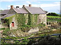
4
The Annalong Watermill from the bridge over the Annalong River
Image: © Eric Jones
Taken: 16 Mar 2011
0.11 miles
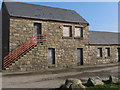
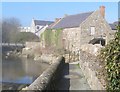
5
The restored Annalong Corn Mill
http://www.culturenorthernireland.org/article/1161/annalong-corn-mill
Image: © Eric Jones
Taken: 23 Apr 2011
0.12 miles
6
The path leading to the Watermill at Annalong
Image: © Eric Jones
Taken: 16 Mar 2011
0.12 miles
7
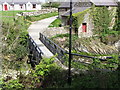
Footbridge over the Annalong River
This footbridge by the mill is the lowest bridging point on the Annalong River.
Image: © Eric Jones
Taken: 23 Apr 2011
0.12 miles
10
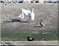
Turf war on the dockside at Annalong
The gander rules the roost on the north side of the dock. This parallels the sectarian divisions in the town with Republican emblems and graffiti to the north and Loyalist emblems and graffiti to the south.
Image: © Eric Jones
Taken: 16 Mar 2011
0.13 miles