Turf marker north of the harbour at Annalong
Introduction
The photograph on this page of Turf marker north of the harbour at Annalong by Eric Jones as part of the Geograph project.
The Geograph project started in 2005 with the aim of publishing, organising and preserving representative images for every square kilometre of Great Britain, Ireland and the Isle of Man.

There are currently over 7.5m images from over 14,400 individuals and you can help contribute to the project by visiting https://www.geograph.org.uk
Turf marker north of the harbour at Annalong
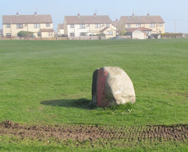
Image: © Eric Jones Taken: 16 Mar 2011
The black and the red on the stone are the colours of the Down GAA teams which draw their supporter mainly from the Catholic community and in predominantly Loyalist Annalong and Kilkeel black and red is used by the residents of the Catholic estates, one which can be seen here in the background, to mark off what they consider to be their territory.
Images are licensed for reuse under creativecommons.org/licenses/by-sa/2.0
Image Location
Latitude
54.109997
Longitude
-5.896173