
IMAGES TAKEN NEAR TO
Victoria Street, BANBRIDGE, BT32 3DQ
Introduction
This page details the photographs taken nearby to Victoria Street, BT32 3DQ by members of the Geograph project.
The Geograph project started in 2005 with the aim of publishing, organising and preserving representative images for every square kilometre of Great Britain, Ireland and the Isle of Man.

There are currently over 7.5m images from over14,400 individuals and you can help contribute to the project by visiting https://www.geograph.org.uk
Image Map
Images are licensed for reuse under creativecommons.org/licenses/by-sa/2.0
Notes
- Clicking on the map will re-center to the selected point.
- The higher the marker number, the further away the image location is from the centre of the postcode.
Image Listing (193 Images Found)
Images are licensed for reuse under creativecommons.org/licenses/by-sa/2.0
Image
Details
Distance
1
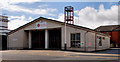
Fire station, Banbridge
Banbridge fire station in Victoria Street.
Image: © Albert Bridge
Taken: 28 Aug 2010
0.03 miles
2

Banbridge NIFR Station
The station stands next to the former courthouse in Victoria Street.
Image: © Eric Jones
Taken: 6 Nov 2013
0.03 miles
3
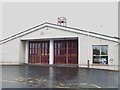
Banbridge NIFR Station
This station, one of 23 in the Southern Command Area (which covers Cos.Down and Armagh), is manned by retained personnel.
Image: © Eric Jones
Taken: 6 Nov 2013
0.04 miles
4
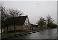
Banbridge Elim Pentecostal Church in Victoria Street
Image: © Eric Jones
Taken: 6 Nov 2013
0.04 miles
5
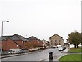
View up Anderson Street, Banbridge
The large building facing the junction of Anderson Street and Scarva Road is the Scarva Road Presbyterian Church.
Image: © Eric Jones
Taken: 6 Nov 2013
0.06 miles
6
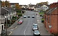
Reilly Street, Banbridge
Reilly Street seen from the Downshire Road. The street was rebuilt in the early 70’s. It was originally a street of small terrace houses and some cottages. The old gasworks was about half-way up the hill on the right.
Image: © Albert Bridge
Taken: 2 Nov 2007
0.06 miles
7
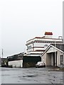
The former court house at Banbridge
This building is now used for public inquiries. At present the 18 month long state inquiry into child abuse in Catholic and State Institutions in Northern Ireland between 1922 and 1995 is based here. This is the UK's biggest inquiry into child abuse. More than 430 victims are scheduled to provide evidence before the inquiry.
http://www.bbc.co.uk/news/uk-northern-ireland-25697391
http://news.sky.com/story/1194084/n-ireland-child-abuse-victims-deserve-payouts
Image: © Eric Jones
Taken: 6 Nov 2013
0.06 miles
9
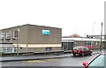
The Health and Social Services Centre, Banbridge
This is located in Scarva Road, next to the Banbridge Library.
Image: © Eric Jones
Taken: 6 Nov 2013
0.06 miles
10
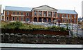
Council offices, Banbridge
The new neo-Georgian Council offices under construction in 1980. They were built on the site of the old market yard off Railway Street. The red-brick wall marks the course of the Castlewellan (left) – Banbridge section of the old GNR(I) line to Knockmore Jct (closed 1955). The line crossed the Downshire Road (foreground but at a site out of photo to the right) by a low overbridge. After the line closed the bridge was demolished allowing the road to be opened to through traffic.
Image: © Albert Bridge
Taken: 12 Jul 1980
0.07 miles