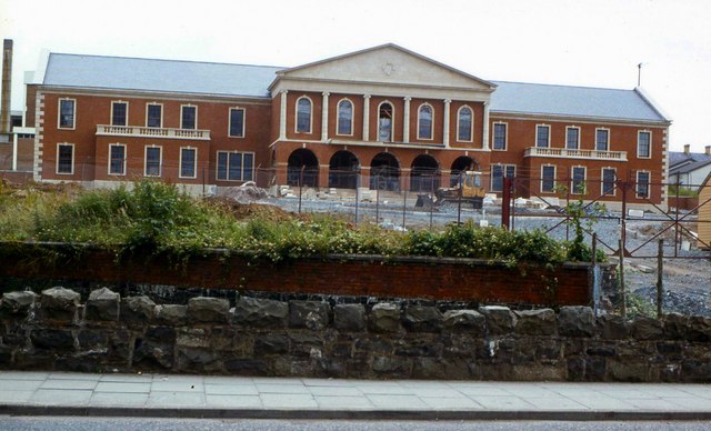
Council offices, Banbridge
Introduction
The photograph on this page of Council offices, Banbridge by Albert Bridge as part of the Geograph project.
The Geograph project started in 2005 with the aim of publishing, organising and preserving representative images for every square kilometre of Great Britain, Ireland and the Isle of Man.
There are currently over 7.5m images from over 14,400 individuals and you can help contribute to the project by visiting https://www.geograph.org.uk

Image: © Albert Bridge Taken: 12 Jul 1980
The new neo-Georgian Council offices under construction in 1980. They were built on the site of the old market yard off Railway Street. The red-brick wall marks the course of the Castlewellan (left) – Banbridge section of the old GNR(I) line to Knockmore Jct (closed 1955). The line crossed the Downshire Road (foreground but at a site out of photo to the right) by a low overbridge. After the line closed the bridge was demolished allowing the road to be opened to through traffic.

