1
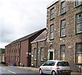
Irish Street, Downpatrick
At the corner with John Street.
Image: © Dean Molyneaux
Taken: 13 Sep 2009
0.02 miles
2
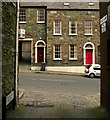
Mary Street off Irish Street, Downpatrick
Image: © Eric Jones
Taken: 20 Aug 2009
0.02 miles
3
Irish Street, Downpatrick
The road narrows into a single lane because of the fortifications at the front of the PSNI barracks.
Image: © Eric Jones
Taken: 20 Aug 2009
0.02 miles
4
The Green Surgery, Irish Street
This Georgian building houses a doctor's surgery.
Image: © Eric Jones
Taken: 20 Aug 2009
0.04 miles
5
Irish Street, Downpatrick
The third of the three streets in Downpatrick reflecting the likely ethnic origin of its inhabitants after settlement in the 17th century. The others are Scotch Street
Image and English Street
Image It runs from Church Street to Stream Street (background). A similar naming pattern can be found in Carrickfergus, Armagh and Dungannon.
Image: © Albert Bridge
Taken: 6 May 2009
0.04 miles
6
Crossroads at the top of Irish Street
Irish Street climbs over a drumlin. Here on the crest is a minor crossroads, with Mary Street branching to the left and The Green to the right.
Image: © Eric Jones
Taken: 20 Aug 2009
0.05 miles
7
Blast Wall protecting Downpatrick's PSNI Barracks
This blast wall restricts the width of Irish Street at this point to one lane and adds to congestion in the city centre. The activities of dissident republican groups, especially RIRA and CIRA, who make the police their target, make it most unlikely that the wall will be demolished soon. This is a pity as it hides the beautiful Georgian facade of the building. PSNI is the acronym of Police Service of Northern Ireland, an awkward mouthful coined by Chris Patten to replace the much crisper former name Royal Ulster Constabulary (RUC).
Image: © Eric Jones
Taken: 20 Aug 2009
0.05 miles
8
Where Irish Street becomes Stream Street
The dividing line between them coincides with the narrow alleyway on the right, known as Folly Lane.
Image: © Eric Jones
Taken: 20 Aug 2009
0.06 miles
9
Stream Street from Folly Lane
Looking out onto Stream Street from Folly Lane in Downpatrick.
Image: © Rossographer
Taken: 26 Feb 2009
0.08 miles
10
The rival on the opposite hill - St Patrick's Catholic Church from the Anglican Cathedral
Image: © Eric Jones
Taken: 20 Aug 2009
0.08 miles


