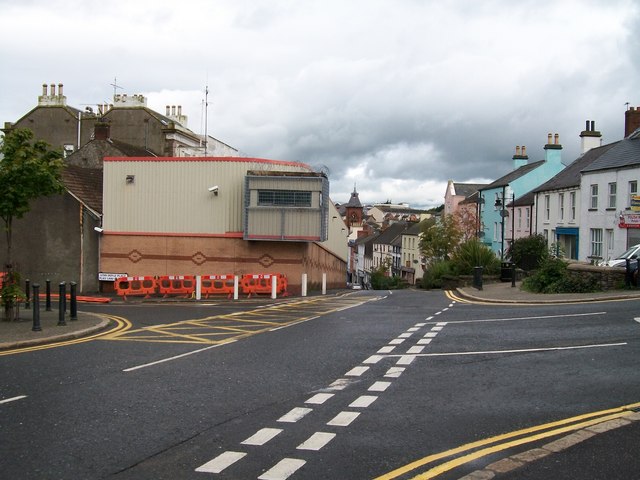
Blast Wall protecting Downpatrick's PSNI Barracks
Introduction
The photograph on this page of Blast Wall protecting Downpatrick's PSNI Barracks by Eric Jones as part of the Geograph project.
The Geograph project started in 2005 with the aim of publishing, organising and preserving representative images for every square kilometre of Great Britain, Ireland and the Isle of Man.
There are currently over 7.5m images from over 14,400 individuals and you can help contribute to the project by visiting https://www.geograph.org.uk

Image: © Eric Jones Taken: 20 Aug 2009
This blast wall restricts the width of Irish Street at this point to one lane and adds to congestion in the city centre. The activities of dissident republican groups, especially RIRA and CIRA, who make the police their target, make it most unlikely that the wall will be demolished soon. This is a pity as it hides the beautiful Georgian facade of the building. PSNI is the acronym of Police Service of Northern Ireland, an awkward mouthful coined by Chris Patten to replace the much crisper former name Royal Ulster Constabulary (RUC).

