IMAGES TAKEN NEAR TO
Shandon Park West, BANGOR, BT20 5JD

Introduction

This page details the photographs taken nearby to Shandon Park West, BT20 5JD by members of the Geograph project.

The Geograph project started in 2005 with the aim of publishing, organising and preserving representative images for every square kilometre of Great Britain, Ireland and the Isle of Man.

There are currently over 7.5m images from over14,400 individuals and you can help contribute to the project by visiting https://www.geograph.org.uk

Image Map


Images are licensed for reuse under creativecommons.org/licenses/by-sa/2.0
Notes
  • Clicking on the map will re-center to the selected point.
  • The higher the marker number, the further away the image location is from the centre of the postcode.

Image Listing (286 Images Found)

Images are licensed for reuse under creativecommons.org/licenses/by-sa/2.0
  • ...
Image
Details
Distance
1
Shadon Park West, Bangor
Short cul-de-sac off Clifton Road. Laid out in the 1920s.
Image: © Rossographer Taken: 9 Jul 2009
0.01 miles
2
Upper Clifton, Bangor
Short street running off Clifton Road and leading, as the sign shows, to Carrisbrooke Image and Victoria Terrace Image
Image: © Rossographer Taken: 9 Jul 2009
0.05 miles
3
Grating, Bangor
An old grating that sits right in the middle of Shandon Drive in Bangor. Although badly worn, the inscription "Union Foundry Belfast" can still just be seen. Interestingly, Shandon Drive has recently been resurfaced and almost all the manhole and grating covers were removed and replaced - this was the only one left untouched, even though it appears to be blocked and serve no useful purpose.
Image: © Rossographer Taken: 2 Apr 2011
0.06 miles
4
Ballyholme Bay and Yacht Club
Taken from Ballyholme Esplanade.
Image: © Dennis Reynolds Taken: 24 Nov 2005
0.06 miles
5
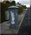
Old electricity box, Bangor
Another of the old electricity boxes found in Bangor. This one is on Shandon Drive. Again marked 'Borough of Bangor Electricity Department'. Made by Johnson & Phillips Electrical Engineers of London. See also http://www.geograph.org.uk/search.php?i=9637907 for some related images.
Image: © Rossographer Taken: 12 Dec 2009
0.07 miles
6
Carisbrooke Terrace
Another nice Bangor terrace, 'Carisbrooke' was built c1875 and has great views across Belfast Lough. Carisbrooke is the top left-hand terrace seen in Image
Image: © Rossographer Taken: 1 Dec 2007
0.08 miles
7
Victoria Terrace
Sitting alongside 'Carisbrooke', 'Victoria Terrace', built c1875-80, may have been originally called 'Ardbraccan'. Victoria Terrace is the top right-hand terrace seen in Image
Image: © Rossographer Taken: 1 Dec 2007
0.10 miles
8
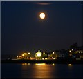
Harvest moon over Bangor
Harvest moon over the Seacliff Road in Bangor. For a similar daylight view of the same area see Image
Image: © Rossographer Taken: 17 Sep 2008
0.10 miles
9
Flats, 150-160 Seacliff Road, Bangor (June 2017)
A block of flats, built circa 1955, for the Bangor Provident Trust. They had been in the course of modernisation for sale but, given the special circumstances, it seems unlikely that the work will re-start soon. The following planning permission (14 December 2017) applies “LA06/2017/0805/F Refurbishment of 12 no. existing apartments including addition of front (sea view) dormers, rear dormers, removal of existing chimneys, change from hipped roof to gable peaks, red brick walls to be rendered (off-white render), new external ramp and existing balconies to be enclosed. (Amended proposal) 150 - 160 Seacliff Road Bangor Co.Down BT20 5HA”. See also Image For a later view, after redevelopment, see Image
Image: © Albert Bridge Taken: 23 Jun 2017
0.10 miles
10
Terraced houses, Bangor
A night view of a terrace on the Seacliff Road in Bangor. Known as 'Seacliff Terrace' and running from numbers 122-144 on the road, the houses were developed c1895. Although they appear to be joined, the two houses on the far left are actually semi-detached, but date from the same period.
Image: © Rossographer Taken: 16 Mar 2011
0.10 miles
  • ...