IMAGES TAKEN NEAR TO
Belfast Road, HOLYWOOD, BT18 9EJ

Introduction

This page details the photographs taken nearby to Belfast Road, BT18 9EJ by members of the Geograph project.

The Geograph project started in 2005 with the aim of publishing, organising and preserving representative images for every square kilometre of Great Britain, Ireland and the Isle of Man.

There are currently over 7.5m images from over14,400 individuals and you can help contribute to the project by visiting https://www.geograph.org.uk

Image Map


Images are licensed for reuse under creativecommons.org/licenses/by-sa/2.0
Notes
  • Clicking on the map will re-center to the selected point.
  • The higher the marker number, the further away the image location is from the centre of the postcode.

Image Listing (60 Images Found)

Images are licensed for reuse under creativecommons.org/licenses/by-sa/2.0
  • ...
Image
Details
Distance
1
"Dudley" stop valve cover, Holywood
A Dudley http://www.geograph.org.uk/search.php?i=31253517 stop valve cover at High street.
Image: © Albert Bridge Taken: 12 May 2012
0.06 miles
2
Belfast Road, Holywood [1]
This was the main road between Belfast and Holywood prior to the bypass opening in 1972. This is the view towards the centre of Holywood.
Image: © Rossographer Taken: 4 Apr 2008
0.06 miles
3
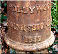
Boundary post, Holywood (2)
A closer look at the boundary post seen in Image It is marked “Hollywood Commissioners” 185(8?). Town Commissioners were the predecessors of urban district Councils (now replaced by district councils) and were mainly abolished at the end of the 19th century. The other interesting point is use of the spelling “Hollywood” rather than the present “Holywood”. The latter reflects the town’s origin in the 7th century and the establishment of a church by St Laisren (Wiki link http://en.wikipedia.org/wiki/Laisr%C3%A9n_mac_Nad_Fro%C3%ADch ) – remembered in an older name for the locality - “Sanctus Boscus”. The Irish version is Ard Mhic Nasca.
Image: © Albert Bridge Taken: 10 Mar 2011
0.07 miles
4
Boundary post, Holywood (1)
A town boundary post on the Belfast Road. For a closer look and a bit more information see Image
Image: © Albert Bridge Taken: 10 Mar 2011
0.07 miles
5
Abbey Ring, Holywood
Abbey Ring runs round and encloses the White City estate. This view is a short distance up from the Belfast Road, beside Sullivan Upper school (behind the hedge on the left).
Image: © Albert Bridge Taken: 30 Oct 2013
0.10 miles
6
Kerr Park sign, Holywood
The sign, beside this road Image
Image: © Albert Bridge Taken: 30 Oct 2013
0.10 miles
7
"For sale" sign, Holywood Rugby Club (July 2014)
A “for sale” sign at the entrance to Kerr Park - geographical and historical record only as per the shared description below.
Image: © Albert Bridge Taken: 5 Jul 2014
0.11 miles
8
Goalposts, Holywood
Goalposts between High Street and the Spafield playing fields Image
Image: © Albert Bridge Taken: 26 Mar 2012
0.11 miles
9
Craigtara, Holywood
Apartments on the southern side of My Lady’s Mile Image
Image: © Albert Bridge Taken: 30 Oct 2013
0.11 miles
10
Access road, Holywood
The road leading from High Street to Kerr Park.
Image: © Albert Bridge Taken: 30 Oct 2013
0.12 miles
  • ...