Boundary post, Holywood (2)
Introduction
The photograph on this page of Boundary post, Holywood (2) by Albert Bridge as part of the Geograph project.
The Geograph project started in 2005 with the aim of publishing, organising and preserving representative images for every square kilometre of Great Britain, Ireland and the Isle of Man.

There are currently over 7.5m images from over 14,400 individuals and you can help contribute to the project by visiting https://www.geograph.org.uk
Boundary post, Holywood (2)
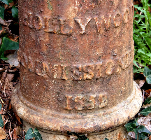
Image: © Albert Bridge Taken: 10 Mar 2011
A closer look at the boundary post seen in Image It is marked “Hollywood Commissioners” 185(8?). Town Commissioners were the predecessors of urban district Councils (now replaced by district councils) and were mainly abolished at the end of the 19th century. The other interesting point is use of the spelling “Hollywood” rather than the present “Holywood”. The latter reflects the town’s origin in the 7th century and the establishment of a church by St Laisren (Wiki link http://en.wikipedia.org/wiki/Laisr%C3%A9n_mac_Nad_Fro%C3%ADch ) – remembered in an older name for the locality - “Sanctus Boscus”. The Irish version is Ard Mhic Nasca.
Images are licensed for reuse under creativecommons.org/licenses/by-sa/2.0
Image Location
Latitude
54.637074
Longitude
-5.839761