1
The entrance to Carrowreagh Road
This image was taken from the Upper Newtownards Road.
Image: © Eric Jones
Taken: 21 May 2012
0.17 miles
2
The Rolls-Royce site, Dundonald (2013-4)
The site seen through the leafless trees on the Upper Newtownards Road.
Image: © Albert Bridge
Taken: 18 Apr 2013
0.18 miles
3
The Rolls-Royce site, Dundonald (2013-2)
A pile of rubble, inside the fence, close to the Carrowreagh Road.
Image: © Albert Bridge
Taken: 18 Apr 2013
0.19 miles
4
The Rolls-Royce site, Dundonald (2013-3)
The former security office, facing the Carrowreagh Road.
Image: © Albert Bridge
Taken: 18 Apr 2013
0.19 miles
5
Ards TT plaque, Dundonald
The Ards TT was a motor race over 13½ miles of public roads. The course started here, on the Upper Newtownards Road, Dundonald and ran via Newtownards (over Bradshaw’s Brae) and Comber. The first race was in 1928. The last in 1936 during which a competitor’s car crashed killing eight spectators.
Image shows the equivalent memorial in Newtownards.
This YouTube video shows a lap of the course in 2007 http://www.youtube.com/watch?v=WvbqCuo5ePg.
Image: © Albert Bridge
Taken: 26 Jun 2011
0.21 miles
6
The Rolls-Royce site, Dundonald (2013-1)
Part of the site close to the northern side of the Upper Newtownards Road.
Image: © Albert Bridge
Taken: 18 Apr 2013
0.23 miles
7
Old European Components Corporation sign, Dundonald
Rolls Royce (Dundonald), Fisher Body, ECC and the factory have all passed into history but this sign remains, attached to a rusty fence, on the Carrowreagh Road.
Image: © Albert Bridge
Taken: 30 Apr 2014
0.24 miles
8
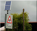
Solar panel. Dundonald
On the Upper Newtownards Road, near Ballyoran Lane, powering flashing lights on a “school” sign.
Image: © Albert Bridge
Taken: 16 May 2010
0.25 miles
9
The Brooklands gospel centre, Dundonald (1)
A gospel centre, at Brooklands Crescent, which replaced a traditional wooden hut. The assembly was established, by the brethren in Dundonald gospel hall
Image, to accommodate those who lived in the then-new Brooklands estate. The building opened (to the best of my knowledge) in 1972. This is the northern side.
Image shows the western side.
Image: © Albert Bridge
Taken: 18 Apr 2013
0.25 miles


