
IMAGES TAKEN NEAR TO
Lecale Street, BELFAST, BT12 6JD
Introduction
This page details the photographs taken nearby to Lecale Street, BT12 6JD by members of the Geograph project.
The Geograph project started in 2005 with the aim of publishing, organising and preserving representative images for every square kilometre of Great Britain, Ireland and the Isle of Man.

There are currently over 7.5m images from over14,400 individuals and you can help contribute to the project by visiting https://www.geograph.org.uk
Image Map
Images are licensed for reuse under creativecommons.org/licenses/by-sa/2.0
Notes
- Clicking on the map will re-center to the selected point.
- The higher the marker number, the further away the image location is from the centre of the postcode.
Image Listing (205 Images Found)
Images are licensed for reuse under creativecommons.org/licenses/by-sa/2.0
Image
Details
Distance
1
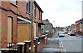
Broadway, Belfast (2)
See Image At the time of the previous photograph (August 2009), the row on the left had been agreed for sale as a site for apartments. Today’s photograph shows that it is now vacant and blocked or boarded-up.
Image: © Albert Bridge
Taken: 5 Jun 2011
0.01 miles
2
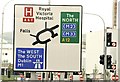
Roundabout sign, Belfast
The sign, in Glenmachan Street, on the approach to the Broadway roundabout over the Westlink underpass Image This one needs more than a bit of thought especially if you happen to be a first-timer.
Image: © Albert Bridge
Taken: 12 Aug 2009
0.03 miles
3
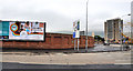
Broadway development site, Belfast (1)
The site (behind the wall) with the Broadway roundabout and Broadway Towers on the right. Glenmachan Street is in the foreground.
Image: © Albert Bridge
Taken: 5 Jun 2011
0.03 miles
4
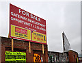
Broadway development site, Belfast (2)
The joint-agents’ “for sale” board facing the Broadway roundabout.
Image: © Albert Bridge
Taken: 5 Jun 2011
0.03 miles
5
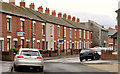
Benburb Street, Belfast (3)
See Image (August 2010). The Donegall Road end of Benburb Street which still has some of the original terrace houses.
Image: © Albert Bridge
Taken: 8 Apr 2012
0.03 miles
6
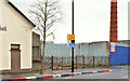
Broadway gospel hall, Belfast (site of)
See Image (April 2012). The vacant ground, on the Donegall Road, formerly the site of Broadway gospel hall. The Monarch chimney Image and site is on the right.
Image: © Albert Bridge
Taken: 8 Feb 2014
0.03 miles
7
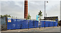
The Monarch Laundry site, Belfast
The vacant site facing the Donegall Road.
Image: © Albert Bridge
Taken: 23 May 2012
0.04 miles
8
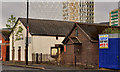
Broadway gospel hall, Belfast (2)
See Image (August 2009). The old wooden hall is still there. The “Rise” sculpture http://www.geograph.org.uk/snippet/5211 now dominates the background. Continue to Image (February 2014).
Image: © Albert Bridge
Taken: 8 Apr 2012
0.04 miles
9
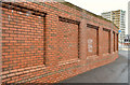
Wall, Broadway roundabout, Belfast
Part of the Broadway development site is enclosed by this brick boundary wall. It has the appearance of being a longer and taller version of this one Image and also resembles Image
Image: © Albert Bridge
Taken: 8 Feb 2014
0.04 miles
10
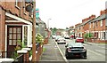
Broadway, Belfast
Broadway was built, over a number of years in the late 19th century, running from the Falls Road via the Donegall Road to Donegall Avenue. The opening of the M1 roundabout, later enlarged for the Westlink and, later still, the Broadway underpass Image and Image severed it. This is the section of the street at Glenmachan Street (off the Donegall Road) looking towards Donegall Avenue. Image shows the same view in June 2011.
Image: © Albert Bridge
Taken: 12 Aug 2009
0.04 miles